Erstfeldertal Bike - 405 SchweizMobil


- 2:00 h
- 14.12 km
- 620 m
- 620 m
- 463 m
- 1,085 m
- 622 m
- Start: Erstfeld, station
- Destination: Erstfeld, station
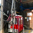
Already after the turn into Talweg, just outside Erstfeld, the majestic Schlossberg shows you the direction. The winding valley road challenges you from the start with a steep climb. On the valley road, you pass the charming hamlets and homesteads typical of dispersed settlements in the Urner mountain areas. At Bergheimetli Wilerli at 1085 m above sea level, you have also reached the highest point of your route. The subsequent singletrail over Plattental, with the short, technically demanding descent via the alp path at Bockitobel, makes the biker’s heart beat faster. At Bockiberg, you reach the most impressive viewpoint of the route. Take a moment to let your gaze wander over the entire valley floor and the lower Reuss valley. In Hofstetten, next to the nostalgic cable car Hofstetten-Wilerli with an open cabin, you reach the valley floor.
Note
The route is continuously signposted with No. 405.

Good to know
Best to visit
Directions
Tour information
Loop Road
Directions & Parking facilities
Additional information
Author
Uri Tourismus AG
Organization
Bikegenoss Zentralschweiz
Author´s Tip / Recommendation of the author
Nearby

