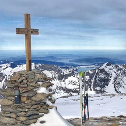
Mutteristock (2,294 m a.s.l.)


The Mutteristock is the highest peak of the Schwyzer Prealps and a very popular touring destination. It offers numerous variant descents over steep, wide slopes.
Ascent / Descent
A)Normal route from Wägitalersee. Difficulty ZS
- Ascent / Descent: 1371m | Uphill on descent: 0m
- Starting altitude: 918 m a.s.l. | Target altitude: 2289 m a.s.l.
- Time required for ascent: 4½ h | Distance: 4.8 km
- Places on the route: Rinderweid (Innerthal - SZ) - Torberglücke - Mutteristock
Descent
B) via Knie. Difficulty S
- Descent: 1372m | Uphill on descent: 0m
- Starting altitude: 2289 m a.s.l. | Target altitude: 917 m a.s.l.
- Time required for descent: 1¾ h | Distance: 3.6 km
- Places on the route: Chruter - Schwantli - Hinter Bruch (Innerthal - SZ)
Other possibilities (without track)
Descent
C) via Oberalp. Difficulty ZS
- Descent: 1403m | Uphill on descent: 37m
- Starting altitude: 2289 m a.s.l. | Target altitude: 918 m a.s.l.
- Time required for descent: 1½ h | Distance: 7.6 km
- Places on the route: Mutteristock - Torberglücke - Nollen (Innerthal - SZ)
Other possibilities (without track)
Descent
D) via Geisswellen. Difficulty ZS
- Descent: 1366m | Uphill on descent: 0m
- Starting altitude: 2289 m a.s.l. | Target altitude: 918 m a.s.l.
- Time required for descent: 1½ h | Distance: 5.8 km
- Places on the route: Mutteristock - Torberglücke
- 4:30 h
- 8.43 km
- 1,380 m
- 1,380 m
- 917 m
- 2,289 m
- 1,372 m
- Start: Wägitalersee, Hinter Bruch
- Destination: Mutteristock
Good to know
Best to visit
- suitableDepends on weather
Directions
- Rinderweid (Innerthal - SZ) - Torberglücke - Mutteristock
Tour information
Circular trail
Equipment
- Tour equipment
- Drinks and food
- Possibly a map
Author
Einsiedeln-Ybrig-Zürichsee Tourismus
Organization
Einsiedeln-Ybrig-Zürichsee
Safety guidelines
Avalanche situation:
In case of uncertain snow conditions, we recommend consulting the avalanche bulletin. Every winter sports participant is responsible for themselves and uses ski tours at their own risk.
Nearby


Download GPX file