Nordic Walking Andermatt


From Andermatt station walk towards the village center to the roundabout and turn towards Oberalp Pass there. After about 10 minutes, leave the pass road to head towards the Unteralp Valley. On a paved road, you soon reach Rohr. At the signpost 150 meters before the Rohr bridge, take a steep climb towards Sattelegghubel and Schöni. This section is located in a wildlife protection zone. From Sattelegghubel follow a flat natural road to Schöni. The next section runs along the Oberalp road to Nätschen. At Nätschen, the railway line is crossed. There follows a short ascent on an asphalt/natural road to the first curve. The subsequent descent through the Chilchenberg protected forest is very impressive. Information boards provide interesting facts about avalanche and protective structures. At the end of the route, you arrive back in Andermatt.
- 2:50 h
- 10.64 km
- 505 m
- 505 m
- 1,436 m
- 1,885 m
- 449 m
- Start: Andermatt Station
- Destination: Andermatt Station
Good to know
Pavements
Best to visit
Directions
Tour information
Loop Road
Nature Highlight
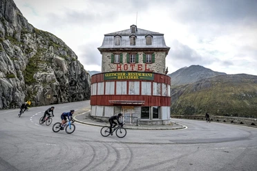
Stop at an Inn
Tour with Dog
Equipment
- Good footwear
- Provisions
Directions & Parking facilities
In summer, Andermatt is very well accessible from all four directions and is therefore a pleasant starting point.
In Andermatt, directly behind the station, there is a large car park. It is only about a 10-minute walk from the starting point of the route.
Andermatt is the connecting point of the Matterhorn Gotthard Railway and is therefore very easily accessible by train. The timetable is as follows: SBB Timetable
Additional information
If you have further questions, please contact: Andermatt Holiday Region, +41 41 888 71 00, [email protected]
Author
Andermatt-Urserntal Tourismus GmbH
Organization
Région de vacances Andermatt
Author´s Tip / Recommendation of the author
- Chilchenberg Plant Educational Trail
Safety guidelines
Nearby

Download GPX file