Path of Creation


Part 1a:
From Morschach-Mattli the path rises about 100 meters to Schwyzerhöchi, then gently descends to Oberschönenbuch. Hikers then follow the flat natural road to Schlattli (Pt. 569) and climb up on the opposite side of the valley to Uf Ibrig. After the ascent, there is a pleasant intermediate section along Ober Gibel. Over the marsh area Chaisten, the mountain path reaches Handgruebi, where the last part leads over the Gründel to the stage end St. Karl (Pt. 1165).
Part 1b:
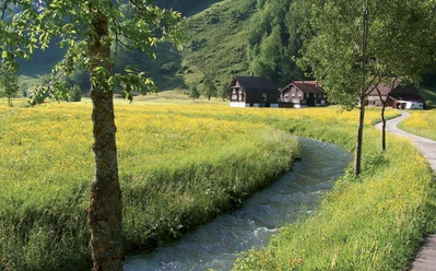
From the Hildegard Hotel St. Karl at 1165 meters above sea level, the mountain path steadily descends on the sunny south slope towards Illgau and from there down the old Fluh path into the valley of the Muota (Pt. 582). After a short sidewalk section, the path turns towards Wigetli/Tristel and follows the rushing Muota to the Wil district. From afar, the stage destination Monastery St. Josef is already visible.
Part 2:
The hiking and mountain paths of the third stage are well developed and almost never lead over paved roads. It goes over extensive alpine pastures, through shady forest areas, wonderful flower meadows, or impressive valley crossings.
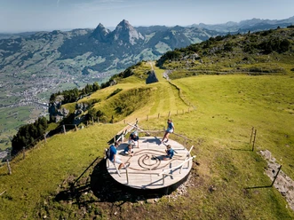
From Monastery St. Josef, the hiking trail follows the Muota to Hinterthal and from there up the deep gorge of the Hüribach to Stali (Pt. 907). A short section downhill and then the forest road turns left towards Frutt and further to Goldplangg. The following mountain path over Wannentritt and various Stoos alp pastures brings hikers to the winter and health resort Stoos. From there, the path continues on the old road to Morschach, where the stage destination Antoniushaus Mattli awaits.
- 15:56 h
- 43.82 km
- 2,278 m
- 2,278 m
- 538 m
- 1,622 m
- 1,084 m
- Start: Morschach
- Destination: Morschach
Good to know
Pavements
Best to visit
Directions
The route starts at Antoniushaus Mattli, over Laui, Dägenbalm, Trümlen to Schwyzerhöchi, descent to Oberschönenbuch, then towards Schlattli, ascent to Uf Ibrig (Aufiberg). Further over Blätzli, Halten, Chaisten to Handgruobi (Hand), over Gründel to the intermediate stage goal St. Karl. Descent over Wart to Illgau, at the village end descent to the valley floor at Sand, over Boden to Will and Muotathal.
From Monastery St. Josef, the hiking trail follows the Muota to Hinterthal, then towards Frutt, Grindsblacken, Suterlis Hut, Föhnen Hut. There keep right towards Uf den Gütschen, then through Goldplangg to Wannentritt. Over Laubgarten to Geissbützen, Rinderchruteren, Brunnerboden to the village Stoos. In the village to the mountain station of the Morschach-Stoos cable car, right of it into the forest and over the old Stoos road (Stooswald) to Nägelisgärtli. Over Dägenbalm to the stage destination Mattli.
Tour information
Stop at an Inn
Equipment
Directions & Parking facilities
By SBB to Brunnen station SBB timetable
Auto AG Schwyz line 2 Schwyz-Brunnen with line 4 from Brunnen to Morschach AAGS timetable
Author
Erhard Gick / Schwyzer Wanderwege
Organization
Schwyzer Wanderwege
Author´s Tip / Recommendation of the author
Antoniushaus Mattli, Morschach Antoniushaus Mattli
Hildegardhotel St. Karl Hildegardhotel
Detour below Geissbützen to Alp Tröligen, the largest alpine cheese dairy on Stoos (with catering and shopping possibilities).
Nearby


Our recommendations