Creation Path Part 1


- 7:00 h
- 20.84 km
- 992 m
- 1,014 m
- 538 m
- 1,189 m
- 651 m
- Start: Morschach
- Destination: Muotathal
Part 1a:
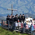
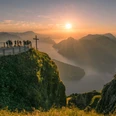
From Morschach-Mattli, the path climbs about 100 metres to the Schwyzerhöchi, before descending leisurely to Oberschönenbuch. Hikers then follow the flat natural road to Schlattli (Pt. 569) and climb up the opposite side of the valley to Uf Ibrig. After the ascent, a pleasant intermediate section follows along the Ober Gibel. Via the Chaisten reed area, the mountain path reaches the Handgruebi, where the last stretch over the Gründel leads to the end of the stage at St. Karl (Pt. 1165).
Part 1b:
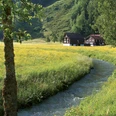
From the Hildegard-Hotel St. Karl at 1165 metres above sea level, the mountain path descends steadily towards Illgau on the sunny southern slope and from there along the old escape route down to the Muota valley (pt. 582). After a short stretch of trottoir, the path branches off towards Wigetli/Tristel and runs along the rushing Muota to the Wil district. The St. Josef monastery can be seen from afar.
Good to know
Pavements
Best to visit
Directions
Tour information
Stop at an Inn
Equipment
Directions & Parking facilities
By SBB to Brunnen railway station SBB timetable
Auto AG Schwyz Line 2 Schwyz-Brunnen with Line 4 from Brunnen to Morschach Timetable AAGS
Author
Erhard Gick
Organization
Schwyzer Wanderwege
Author´s Tip / Recommendation of the author
Antoniushaus Mattli, Morschach Antoniushaus Mattli
Hildegardhotel St. Karl Hildegardhotel
Safety guidelines
Antoniushaus Mattli, Morschach Antoniushaus Mattli
Hildegardhotel St. Karl Hildegardhotel
Nearby