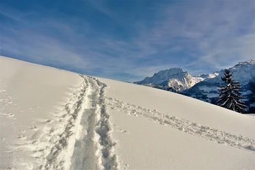
Seestock (2428 m.a.s.l.)


The tour starts at the Swiboden to southwest transition to between Mattner First and Rossgrat. From the terrace of Schafsätz to Oberalp it continues to Gratsattel and finally on foot to the summit.
- 4:00 h
- 11.07 km
- 1,179 m
- 20 m
- 847 m
- 2,026 m
- 1,179 m
- Start: Gasthaus Schwarzenbach
- Destination: Seestock (Gipfel)
Good to know
Pavements
- Street (4%)Trail (82%)Path (14%)
Best to visit
- suitableDepends on weather
Directions
- At the Schwarzenbach inn go up to Seestock (summit).
Equipment
- Enough food and united condition
Directions & Parking facilities
- Getting thereFrom highway exit Schwyz - direction Muotathal and then follow the signs Husky-Lodge. The Husky-Lodge is located about 1 km outside the village. Travel time from the highway exit Schwyz to Muotathal is about 20 minutes.ParkingThere are plenty of parking spaces available on site.Public transportationFrom Schwyz SBB train station take the Auto AG Schwyz bus in the direction of Muotathal.
Bus stop "Muotathal, Hintere Brücke" from the bus stop approx. 15 min walk along the right bank of the Muota to the Husky Lodge (gravel path starts behind the Restaurant Sonne. We recommend a backpack instead of a suitcase) However, depending on snow conditions, we recommend to walk left along the road.
Additional information
- For guests at the Husky-Lodge to the Schwarzenbach Inn, Return
Author
Stoos-Muotatal Tourismus
Organization
Stoos-Muotatal Tourismus
Author´s Tip / Recommendation of the author
- Chauffeur by bus from the Husky Lodge to the start of the route and in good conditions via Hürital to the hut hotel.
Safety guidelines
- The Gruebiwald path may not be left until the Stäfeli Alp, as it is in the area of a game resting zone.
Ski touring routes are not marked and prepared. Access at your own risk. Please observe the following rules of conduct on the ski tour.
Healthy and fit in the mountains
Good fitness through regular endurance and weight training. Make sure you have reserves of strength for the descent.Careful tour planning
Pay special attention to the weather forecast, as cold, wind and poor visibility increase the risk of accidents considerably. Plan alternative routes and checkpoints.Complete equipment
Standard emergency equipment includes avalanche transceiver, shovel and probe, first aid kit, bivy sack, cell phone (Euro emergency 112) and an airbag system.Avalanche situation report
Inform yourself in detail about the avalanche danger before the tour! What is the danger level, where are the danger spots, what are the current avalanche problems.Weigh the avalanche risk
Base your decisions therefore on strategic methods of risk assessment (reduction methods) and pay attention to danger signs in the terrain.Orientation and rest
It is important to master the use of map, altimeter, compass, app or GPS. Drinking, eating, and taking breaks are necessary to maintain performance and concentration.Keep clearances
Clearances serve to relieve the snowpack and limit damage. Relief distances of 10 m when ascending steep slopes also increase comfort when making hairpin turns. When skiing downhill, always keep distances of at least 30 m and ski very steep slopes individually.Avoid falls
Falls on the descent are the most frequent cause of accidents on ski tours. For the snow surface they mean a large additional load.Small groups
Small groups (up to 6 people) increase safety. Communication with other winter sports enthusiasts and mutual consideration prevent dangerous situations.Respect for nature and environment
Be considerate of wildlife, respect protected areas and do not enter reforested areas. To get there, carpool or use public transportation.