Urner Alpenkranz 40th stage: Spannorthütte - Surenenpass - Brüsti


The descent from the Spannorthütte SAC (1956 m) to Alp Stäfeli follows the switchbacks of the narrow, grassy Geissrücken, sometimes left of the ridge, sometimes right. We overcome two narrow passages on scree slopes and a short, secured scramble. Along the entire section, many sheep graze in summer, which can dislodge stones. Caution is therefore advised.
At Stäfeli (1392 m) we cross the Stierenbach and tackle the first steep stage toward Blackenalp (1769 m). At this legendary place, we like to rest with the Urner alpine farmers and enjoy an unadulterated Urner coffee in the hospitable hut. The path beside the rock faces of Blacken- and Brunnistock becomes steeper and after a small shelter reaches the Surenenpass (2292 m). The descent over still existing snowfields progresses quickly. Past Angistock we reach Nussfruttli (1954 m) and over the Geissrücken to the Alp Grat (1809 m). From here we hike to the rocky Chräienhöreli and after the ridge follow the alpine path. Through the open mountain forest, we descend through the plant protection area to Brüsti (1528 m).
- Technical difficulty: T3, white-red-white
- 5:45 h
- 14.27 km
- 950 m
- 1,377 m
- 1,386 m
- 2,293 m
- 907 m
- Start: Spannorthütte
- Destination: Brüsti
Good to know
Pavements
Best to visit
Directions
Spannorthütte - Stäfeli - Blackenalp - Surenenpass - Angistock - Geissrücken - Alp Grat - Chräienhöreli - Brüsti
Tour information
Cultural Interesting
Familiy-Friendly
Nature Highlight
Stop at an Inn
Equipment
- Sturdy hiking boots with grippy soles, weather-appropriate equipment, topographic national maps (not just smartphone), compass and altimeter are part of the basic equipment.
- Additionally, a pocket first aid kit, emergency blanket and mobile phone for emergencies belong to the basic equipment.
- Hiking poles are very helpful, especially with a heavy backpack.
Directions & Parking facilities
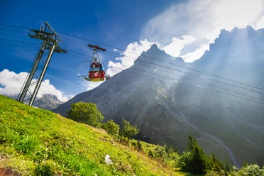
Arrival and/or departure via Engelberg by bus to the valley station of the Fürenalp cable car or via Flüelen to Attinghausen by bus to the valley station of the Attinghausen-Brüsti cable car.
www.attinghausen-tourismus.ch/seilbahn-skilift/attinghausen-bruesti/
Additional information
- www.alpenkranz.ch
- There are three possible accommodations at Brüsti; Alp Grat, Berggasthaus Brüsti and Berggasthaus Alp Catrina.
- Experiences in the Uri holiday region can be found here: uri.swiss
- Local mountain guides and qualified hiking leaders can be found at: Montanara Bergerlebnisse, Bergführerverein Uri and Honigberg.ch.
Literature
Author
Sanna Laurén
Organization
Verein Urner Wanderwege
Author´s Tip / Recommendation of the author
Tip:
Take your time and stop at the alpine huts on the way.
Those who have hiked the entire Urner Alpenkranz will fondly recall this unforgettable adventure route.
Option:
The Eggenmanddli (2448 m) is a rewarding extra peak of the Surenenpass with wonderful views over the impressive Urner mountain landscape and Lake Uri.
Safety guidelines
Mountain hiking is demanding. For mountain and alpine hiking trails, knowledge of dangers in the mountains (rockfall, risk of slipping/falling, sudden weather changes) is necessary. Sturdy hiking boots with grippy soles, weather-appropriate equipment, topographic national maps (not just smartphone), compass and altimeter are part of the basic equipment. Additionally, a pocket first aid kit, emergency blanket and mobile phone for emergencies belong to the basic equipment.
It is advisable to do serious route planning and careful preparation for every hike. The weather in the mountains can change very quickly. Fog can make orientation difficult even in summer. The greatest danger in summer besides heat are thunderstorms. Thunderstorms with heavy rain and hail quickly turn small streams into large rivers and increase the risk of mudslides and rockfalls. Therefore, it is important to interpret the weather report when planning routes. Thermal thunderstorms often come only in the afternoon, but frontal thunderstorms can occur at any time of day. Generally, it is worth starting early in the summer.
Mountain guides or qualified hiking leaders (up to T4) are recommended for alpine hiking trails (white-blue-white marked route), hiking guides for hikes and mountain hikes. They take over organization and planning of hikes so guests can simply enjoy the hike.
The Urner Wanderplaner and the Uri Outdoor App help with planning. Through Geo Admin, many useful pieces of information can be found, such as where pastures with herd protection dogs, cow-calf pastures, and wildlife resting zones are located.
Hikers hike at their own risk. The Urner Wanderwege association is not liable for accidents that occur during the Urner Alpenkranz hike.
Map
Bike and hiking map of the Canton of Uri, Maderanertal sheet.
The "Maderanertal" sheet is available in the web shop of Urner hiking trails: www.urnerwanderwege.ch/de/shop
Nearby
