Wisstannenweid SZ004

- 3:30 h
- 7.57 km
- 509 m
- 509 m
- 900 m
- 1,410 m
- 510 m
- Start: Unter Schweig
- Destination: Unter Schweig
Good to know
Pavements
Unknown (55%)
Asphalt (11%)
Gravel (3%)
Trail (22%)
Path (9%)
Best to visit
suitable
Depends on weather
Directions
Unter Schweig - Zipfel - Heitligeer - Stockrain - Wisstannenweid - Heitligeer - Zipfel - Unter Schweig
(SVS circular route Wisstannenweid SZ 004)
Tour information
Loop Road
Equipment
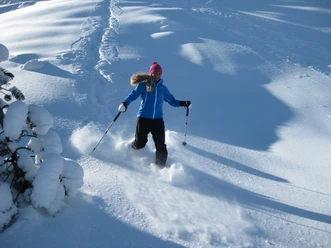
Recommended equipment for snowshoe hikers:
- Snowshoes, winter shoes (good hiking boots), depending on weather conditions wind jacket, sweater, gloves, hat, sunglasses, gaiters, and hiking poles
- For longer routes, backpack with drink and food
- Recommended are map 1:25000, compass, if available GPS
- First aid kit and possibly needed medication
Directions & Parking facilities
Getting there
By car from Einsiedeln towards Gross - Euthal
Public transportation
By bus from Einsiedeln towards Gross - Euthal
Additional information
For the sake of wildlife:
- Attention: Please respect the recommended wildlife resting area.
- In winter, wild animals need quiet retreat areas to survive.
- Please stay on the route so that wild animals are not disturbed.
- We ask you to keep your dog on a leash.
Author
Schwyz Tourismus / Schwyzer Wanderwege
Organization
Einsiedeln-Ybrig-Zürichsee
Safety guidelines
For your safety – stay on the route!
SVS snowshoe routes are marked, signposted, avalanche safe, and environmentally friendly.
Order snowshoe maps from the Swiss Snowshoe Association (www.s-v-s.ch)
Attention:
Leaving the route in the nature reserve and hunting ban area is prohibited!
Nearby

Download GPX file