3-day route stage 1: Marbachegg - Flühli 35km


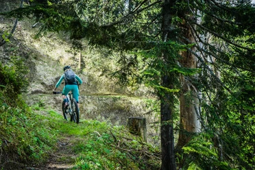
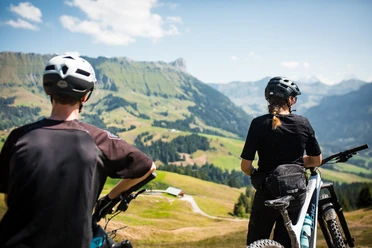
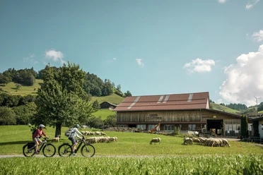
A "flowy" route takes you down to Kemmeriboden-Bad and from there with a "blue" or "red" level of difficulty via Salwideli through the colorful moorland landscape to Rossweid in Sörenberg. After a leisurely descent, the stage finish is reached at the Kurhaus Flühli. For the more ambitious, there is the "red" option of a final ascent with bombastic views and an additional downhill run. A short trip to the Kneipp facility is also a wonderful experience.
- 4:00 h
- 34.85 km
- 794 m
- 1,377 m
- 885 m
- 1,469 m
- 584 m
- Start: Marbachegg- Kadhus Spycher
- Destination: Flühli village
Waypoints
Good to know
Pavements
- Street (20%)Asphalt (39%)Gravel (13%)Trail (23%)Path (6%)
Best to visit
- suitableDepends on weather
Tour information
Refreshment stop
Equipment
- Luggage transport is organized for you on the multi-day tour!
- Good equipment including rain and heat protection, repair and first aid kit are always included on an MTB tour. Wearing a helmet is a matter of course and a light is required at dusk.
Directions & Parking facilities
- Getting there- The UNESCO Biosphere Entlebuch is located in the heart of Switzerland, centrally between Bern and Lucerne. You can reach Marbach via the main road 10 in the direction of Wiggen. From Thun you can reach Marbach via the Schallenberg.
Plan your route using the Google route planner.
ParkingA free parking lot is available at the Marbachegg sports lifts.Public transportationYou can reach Marbach by public transport via Escholzmatt (BLS Bern-Lucerne railroad line). From Escholzmatt, take the post bus to Marbach "Talstation Marbachegg".Plan your journey with the SBB online timetable.
Additional information
- Escholzmatt-Marbach Tourism
Marbach office
Dorfstrasse 61
6196 Marbach (LU)
Tel. +41 (0)34 493 38 04
www.escholzmatt-marbach-tourismus.chBiking in the UBE: 🔗 Bike experiences in the Entlebuch biosphere
Culinary delights in the UBE: 🔗 Culinary delights on the go
Fireplaces & picnic areas in the UBE: 🔗Fireplaces& picnic areas
Author
Escholzmatt-Marbach Tourismus
Organization
UNESCO Biosphäre Entlebuch
Author´s Tip / Recommendation of the author
- Each stage location offers you a tourist highlight - be inspired by the variety of experiences!
Blue variant:Asphalt (42%) 14.3 km / elevation gain +347m / elevation loss -616m
Natural surface (58%) 19.4 km / elevation gain +557m / elevation loss -875mRed variant:
Asphalt (51%) 16.8 km / elevation gain +184m / elevation loss -940m
Natural surface (49%) 16.4 km / elevation gain +796m / elevation loss -625m
Safety guidelines
- Wear the right protective equipment, assess your ability correctly, give way to hikers, stay on the trail and close pasture fences!
- Follow the Central Switzerland Bike Code - that way you'll stay safe on your mountain bike!