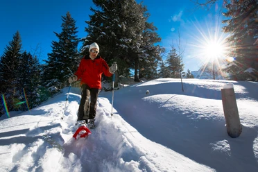
Arnisee Trail


The trail runs over Hinterarni, which is also directly accessible by the Intschi-Arnisee cable car, towards Mittelarni. While the snow crunches underfoot, the view wanders over the Reuss Valley and to Gross and Chli Windgällen.
Passing huts and stables, you reach Arnisee again. To finish, a somewhat more demanding additional loop leads further to the mountain chapel, over Torli to Diessenbrunnen, and back to the Intschi-Arnisee mountain station.
- 2:45 h
- 6.73 km
- 249 m
- 244 m
- 1,289 m
- 1,409 m
- 120 m
- Start: Hinterarni
- Destination: Hinterarni
Good to know
Pavements
Unknown (63%)
Trail (22%)
Path (15%)
Best to visit
suitable
Depends on weather
Directions
Intschi-Arni cable car mountain station - Arnisee - Rüti - Hinterarni - Mittelarni - Vorderarni - Mittearni - Hinterarni - Arnisee - Torli - Diesenbrunnen - Schwändli - Intschi-Arni cable car mountain station
Tour information
Loop Road
Mountain Railway Tour
Stop at an Inn
Equipment
- Poles
- Snowshoes
- Avalanche equipment (transceiver, probe & shovel)
- Weather-appropriate clothing
Additional information
Author
Andermatt-Urserntal Tourismus GmbH
Organization
Région de vacances Andermatt
Author´s Tip / Recommendation of the author
- Rent snowshoes (Amsteg-Arnisee mountain station or Restaurant Alpenblick)
- Full moon hike
Safety guidelines
Observe the current avalanche situation
Nearby
Download GPX file