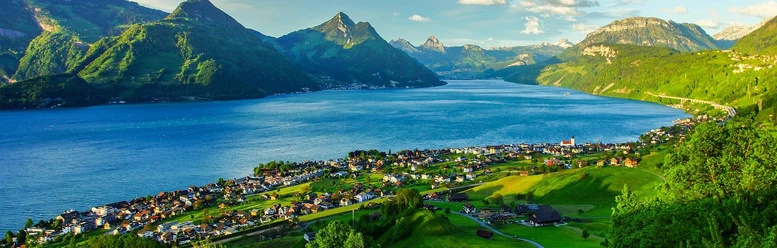
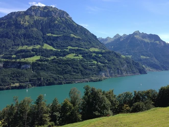
Beckenried-Risletenschlucht-Treib


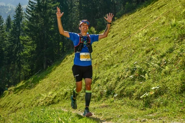
Up to the Risleten rocks you walk on a paved road, mostly along Lake Lucerne. Then it continues on hiking trails. Just after passing the gorge, the path requires some stamina as it ascends about 300 meters in a short distance. After that, the hike is very pleasant with slight ups and downs.
The hike is also recommended in less than ideal weather. It is especially interesting if it rained the day before, as then a lot of water rushes down through the gorge.
The return trip from Treib to Beckenried is enjoyed relaxed by ship. Of course, the hike can also be undertaken in the opposite direction.
- 3:30 h
- 10.48 km
- 416 m
- 406 m
- 435 m
- 722 m
- 287 m
- Start: Beckenried
- Destination: Treib, respectively Beckenried
Good to know
Pavements
Best to visit
Directions
Beckenried-Risletenschlucht-Treib
Tour information
Nature Highlight
Equipment
Good footwear and weather-appropriate clothing.
Directions & Parking facilities
Motorway A2 Lucerne-Gotthard, two exits for Beckenried
Paid parking spaces available in Beckenried
By train and bus to Beckenried
Arrival also possible by ship
Ship connections from Beckenried to Treib run every hour in summer.
Additional information
More hiking tips: nidwalden.com/wandern
Author
Nidwalden Tourismus
Organization
Nidwalden Tourismus
Author´s Tip / Recommendation of the author
Climbing on the large Risleten rocks: Information about the Risleten climbing garden can be found here.
Those who scan the rocks with their eyes can, with some luck, discover the ancient dinosaur tracks.
Safety guidelines
After rainfall, the forest path can be a bit slippery. It is therefore recommended to wear good footwear.

Nearby


