Bonistock Trail, Melchsee-Frutt


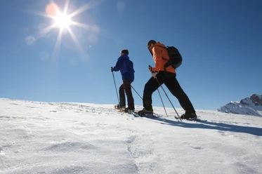
After a few meters on the winter hiking trail, it starts behind the frutt Lodge & Spa hotel. Strap on your snowshoes and start the ascent to Bonistock. The path steadily climbs along the ridge and offers a great view of the Melchsee-Frutt high plateau.
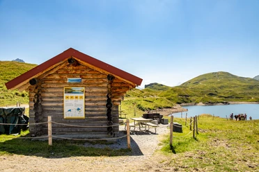
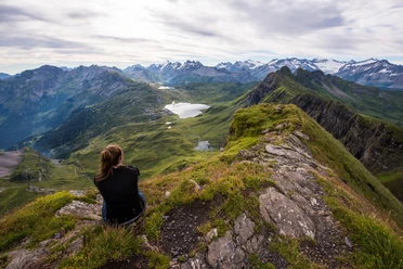
Invigorated by the many natural beauties, you reach the highest point of the route. Enjoy the incomparable panoramic view. From here, continue past the mountain station of the Bonistock chairlift to Chringen. The passage over Chringen can be a smaller or bigger challenge depending on the snow drift. After mastering the crossing, begin the leisurely descent to Tannalp. Take a break and let the silence absorb you or refresh yourself at the restaurant for the return journey.
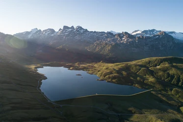
Return goes parallel to the cross-country ski trail along Tannensee and further below the Bonistock rock to the Panorama lift. Take it – nearly 40 meters above Melchsee, the view over the Alpine pearl is even more impressive. Let the day pass by again on the short stretch back to the gondola and take many experiences home with you.
- 4:15 h
- 9.02 km
- 272 m
- 279 m
- 1,894 m
- 2,166 m
- 272 m
- Start: Melchsee-Frutt, mountain station
- Destination: Melchsee-Frutt, mountain station
Waypoints
Good to know
Best to visit
Tour information
Loop Road
Directions & Parking facilities
From Lucerne, take the tunnel onto the A8 towards Interlaken, switch to Sarnen and then continue on the A8 to the exit Sarnen Nord, Kerns. Use the left lane at the exit towards Kerns.
From Interlaken via Brünig on the A8 to the exit Sarnen Nord, Kerns. At the exit, stay right and turn towards Kerns.
Follow the road through the villages Kerns, St. Niklaus and Melchtal to the very back of the valley to Stöckalp.
Additional information
Current information about snow conditions can be found at www.melchsee-frutt.ch
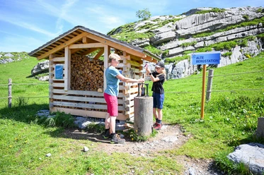
Signage: The route is marked with marking posts.
Author
Obwalden Tourismus
Organization
Obwalden Tourismus
Nearby

Download GPX file