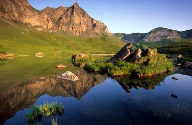
Blauseeli Trail, Melchsee-Frutt

Brevity is the spice of life: Start at the "old mountain station". Follow the markings to Stäubiloch, from here the route is hilly in the direction of Aa Alp to Teufiboden.
With Hochstollen and Brünighaupt in the background, continue in the direction of Glogghuis and after a few more ups and downs you will reach Blauseeli.
Enjoy the peace and quiet and take in the unspoiled nature before you hike back to Frutt-Dörfli via Vogelbüel.
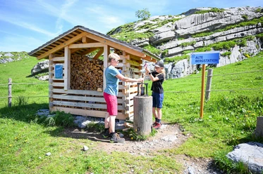
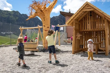
The trail is ideal for beginners and families with children - not least because on the way back to Melchsee-Frutt you pass through the children's paradise of Fruttliland with its various play areas.
- 1:30 h
- 3.42 km
- 67 m
- 69 m
- 1,858 m
- 1,923 m
- 65 m
- Start: Old Melchsee-Frutt mountain station
- Destination: Old Melchsee-Frutt mountain station
Waypoints
Good to know
Best to visit
Directions
Tour information
Loop Road
Directions & Parking facilities
From Lucerne, change to the A8 in the tunnel in the direction of Interlaken, Sarnen and then continue on the A8 to the exit, Sarnen Nord, Kerns. At the exit, take the left lane in the direction of Kerns.
From Interlaken via Brünig on the A8 to the Sarnen Nord, Kerns exit. Take the right-hand lane at the exit and turn off towards Kerns.
Follow the road through the villages of Kerns, St. Niklaus and Melchtal until you reach Stöckalp at the end of the valley.
Additional information
Snow report:
You can find the latest information on snow conditions at www.melchsee-frutt.ch
Author
Obwalden Tourismus
Organization
Obwalden Tourismus
Nearby

Download GPX file