Erstfeldertal Bike - 405 SwitzerlandMobility


The tour starts in Erstfeld and leads directly into the side valley of the same name. Shortly after the village, the striking Schlossberg mountain points the way. The route climbs steadily along the winding valley road, with some steeper sections right from the start. Along the way, you pass typical Uri scattered settlements, small hamlets and remote homesteads, which give the valley its original character.
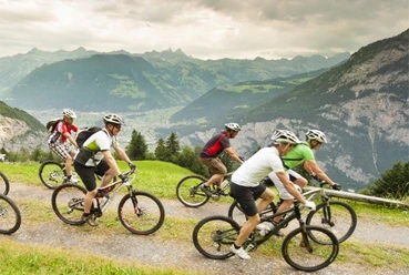
At Bergheimetli Wilerli at around 1,085 m above sea level, the tour reaches its highest point. M. the tour reaches its highest point. This is followed by the most varied part of the tour: a beautiful single trail leads through the Plattental valley before a short, technically demanding descent along the alpine path at Bockitobel. The viewpoint at Bockiberg is particularly impressive, with views over the entire valley floor and the lower Reuss valley.
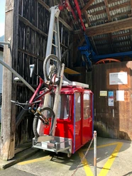
You then return to the valley floor via Hofstetten. Right next to the nostalgic Hofstetten-Wilerli aerial cableway, the route leads leisurely along the Reuss back to Erstfeld. A short but varied tour for bikers looking for a mixture of natural roads, views and the first technical trail sections.
- 2:00 h
- 14.12 km
- 620 m
- 620 m
- 463 m
- 1,085 m
- 622 m
- Start: Erstfeld, railroad station
- Destination: Erstfeld, railroad station
Good to know
Best to visit
- suitableDepends on weather
Directions
- Erstfeld - Sagerberg - Wilerli - Scheidweg - Bocki - Hofstetten - Erstfeld
Directions & Parking facilities
- Getting thereComing from the A2 highway, drive in the direction of Erstfeld, Erstfeld station.ParkingPaid parking lot at Erstfeld station.Public transportationTake the bus or train to Erstfeld station, which is the starting point for this tour.
Additional information
- Fairtrail Central Switzerland
In Central Switzerland, we share many trails with hikers, families and other nature users. With a friendly greeting, appropriate speed and mutual respect, we work together to ensure that biking remains possible here in the future. Thank you for being fair on the trail.
Author
Uri Tourismus AG
Organization
Bikegenoss Zentralschweiz
Author´s Tip / Recommendation of the author
- Combination with various singletrail sections possible
- Bike transport at the Hofstetten-Wilerli cable car
Safety guidelines
- Mountain biking in alpine terrain requires good self-assessment and appropriate equipment. Find out about the weather, trail conditions and any closures before the tour. Ride in a controlled manner, be considerate of other trail users and wear a helmet for your own safety. Conditions can change quickly in the mountains.