Grottenweg


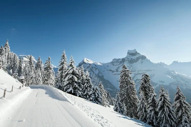
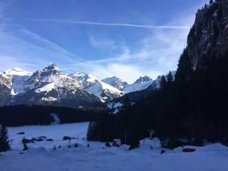
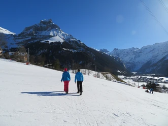
Winter hiking with a view – this awaits hikers on the Grottenweg up to the End of the World. The Titlis, the local mountain Hahnen, and the Spannörter present themselves and inspire awe.
The path starts at Engelberg station and leads to the end of the village street by the monastery chapel. It continues up the stairs to the street. From there, the Grottenweg branches off to the right towards Klostermatte, where you can watch the lively bustle in Globi's children's land. Tomorrow's ski pros playfully tackle their first turns in the snow here. The high route continues on the marked path past the seven springs. In winter, they are covered with snow and ice, but in summer the water flows here crystal clear and pure from the ground. Continuing on the winter path, the next highlight is reached when arriving at the forest edge – the Lourdes grotto. The Virgin Mary is clearly visible on a rock ledge. After lighting a candle or taking a short break, you cross the bridge and follow the left along the Bärenbach towards Horbis, the so-called End of the World. Returning to Engelberg, the free local bus can also be used from Neuschwändi.
- 1:45 h
- 6.24 km
- 132 m
- 132 m
- 1,000 m
- 1,132 m
- 132 m
- Start: Engelberg Station
- Destination: Restaurant End of the World (Horbis)
Waypoints
Good to know
Best to visit
Directions
Tour information
Stop at an Inn
Equipment
Directions & Parking facilities
Additional information
Author
Engelberg - Titlis Tourismus
Organization
Engelberg-Titlis Tourismus
Author´s Tip / Recommendation of the author
Safety guidelines
When planning, please check the winter sports report at engelberg.ch https://www.engelberg.ch/offene-anlagen/winter/ to see whether the winter hiking trails are tracked and open.
Nearby