Hirsegg - Bodenhütte - Hirsegg

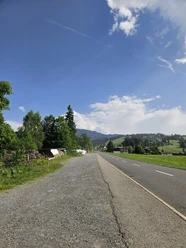
The hike starts in Hirsegg and leads uphill on a pleasant path towards Schlüechtli. You walk through varied landscapes with pastures, sparse forest, and alpine meadows – always at the foot of the impressive Schrattenfluh.
Further on, it goes slightly uphill and then more gently until you reach Bodenhütte, a small alp in an open location. The view repeatedly opens towards Brienzer Rothorn and the surrounding mountain panorama.
The return path leads partly through shady forest trails and meadow slopes back to Hirsegg, where the circular route ends.
- 2:35 h
- 7.24 km
- 402 m
- 402 m
- 1,070 m
- 1,469 m
- 399 m
Good to know
Pavements
Best to visit
Tour information
Loop Road
Equipment
Good footwear, rain jacket & sufficient drinking water are essential for every hike.
More tips for safe hiking, information about cow-calf herds and guard dogs, and much more can be found on the Swiss Hiking Routes website.
Directions & Parking facilities
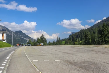
You can reach Sörenberg via main road 10 towards Schüpfheim, and from there to Flühli Sörenberg up to the village center of Sörenberg.
In summer, you can reach Sörenberg via Sarnen - Giswil over the Glaubenbielen Pass.
A paid parking lot is available at Hirsegg.
You can reach Sörenberg by public transport via Schüpfheim (Bern-Lucerne train line). From Schüpfheim, take the post bus to Sörenberg, Post. Plan your trip with the SBB online timetable.
Author
Sörenberg Flühli Tourismus
Organization
UNESCO Biosphäre Entlebuch
Author´s Tip / Recommendation of the author
Travel by public transport. The post bus stops directly at the start and end point.
Nearby

Download GPX file