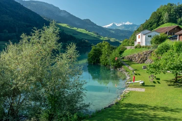
Lungerersee


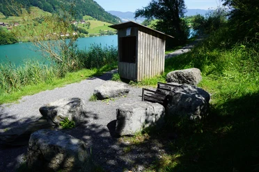
The route runs almost entirely on natural roads and paths around the emerald green Lungerersee. In addition, most of it is flat. If you need a break along the way, you can enjoy the wonderful mountain panorama and the lake on one of the benches.
- 1:32 h
- 9.76 km
- 76 m
- 99 m
- 689 m
- 757 m
- 68 m
Waypoints
Good to know
Best to visit
suitable
Depends on weather
Tour information
Loop Road
Directions & Parking facilities
Getting there
From Lucerne on the A8 towards Interlaken, either park in Kaiserstuhl or continue to the village of Lungern.
Parking
Parking, for example near the Lungern church or a few parking spaces in Kaiserstuhl
Public transportation
By train to Kaiserstuhl or Lungern
Author
Obwalden Tourismus
Organization
Obwalden Tourismus
Nearby

Download GPX file