Marbachegg - Bumbach - Marbach


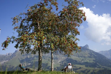
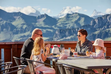
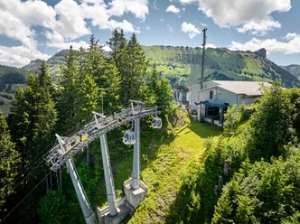
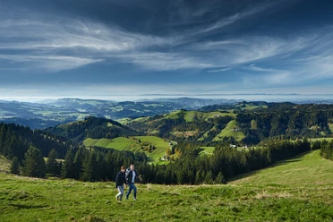
On this hike, you can cover the first altitude meters using the Bretzeli-Bahn of the Marbachegg ski lifts. The base station is located a little outside the village of Marbach. Once at Marbachegg, you will surely marvel at the wide view to the Schrattenfluh and Hohgant, with the snowy-tipped Bernese high Alps towering in between. Take your time and enjoy the view. At the mountain inn, you can start the day from Monday to Saturday with a mountain breakfast buffet and go hiking strengthened.
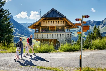
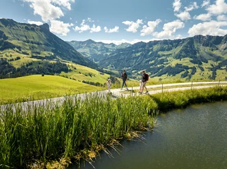
The hike starts right at the mountain inn past the storage pond toward Oberlochsitli and Wittenfärren. At the first junction after Oberlochsitli, turn right toward Unterlochsitli. Shortly after Unterlochsitli, you have already crossed the border to the canton of Bern and are now in the hilly landscapes of the Emmental. Continue to follow the hiking trails down to the Emme. Now follow the Emme for quite a stretch. Why not use the refreshing water for a foot bath? In the Port area, you cross the Emme again and head towards the village of Schangnau. Opposite the Löwen guesthouse, follow the signpost to Kemmeriboden-Bad and continue following the hiking trail toward Marbach. Along the Schonbach, it goes back to Marbach and the base station of the Marbachegg ski lifts.
- 4:00 h
- 13.97 km
- 170 m
- 770 m
- 861 m
- 1,468 m
- 607 m
- Start: Base station, Marbachegg ski lifts
- Destination: Base station, Marbachegg ski lifts
Good to know
Pavements
Best to visit
Directions
Marbachegg - Bumbach - Schangnau - Marbach
Tour information
Mountain Railway Tour
Stop at an Inn
Equipment
Good footwear, rain jacket & sufficient drinking water for the journey are part of every hike.
More tips for safe hiking, information about suckler cow herds and herd protection dogs, and much more can be found on the website of the Swiss Hiking Routes.
Directions & Parking facilities
The UNESCO Biosphere Entlebuch lies in the heart of Switzerland, centrally located between Bern and Lucerne. You reach Marbach via main road 10 towards Wiggen. From Thun, you reach Marbach over the Schallenberg.
Plan your route using the Google route planner.
A free parking lot is available at the base station of the Marbachegg ski lifts.
You can reach Marbach by public transport via Escholzmatt (Bern-Lucerne railway line). From Escholzmatt, take the post bus to Marbach "Base station Marbachegg."
Plan your trip with the SBB Online Timetable.
Additional information
Escholzmatt-Marbach Tourism
Tourism office Marbach
Dorfstrasse 61
CH- 6196 Marbach
Phone +41 (0)34 493 38 04
www.escholzmatt-marbach-tourismus.ch
Literature
The summer panoramic map "Hiking" with many interesting hiking suggestions around Marbach is available at: Escholzmatt-Marbach Tourism
Author
Escholzmatt-Marbach Tourismus
Organization
UNESCO Biosphäre Entlebuch
Author´s Tip / Recommendation of the author
Visit the Arche Farm Schangnau. Arche farms are meeting centers where endangered livestock and their preservation and promotion can be experienced firsthand.

Nearby
