Marbachegg - Hürnli - Marbach


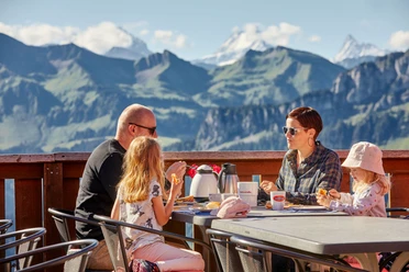
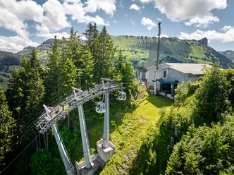
The first altitude meters are covered with the Bretzeli-Bahn of the Marbachegg ski lifts. The gondola starts slightly outside the village of Marbach and ascends on the north side to the point with the unexpected, special view – Schrattenfluh and Hogant form the horizon, between them the view opens to the Bernese Alps with Schreckhorn, Finsteraarhorn and Eiger. A first stop is worthwhile on the sunny terrace of the mountain inn, refresh yourself with a breakfast or a first thirst quencher.
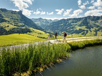
The hike starts from Marbachegg and leads past the reservoir lake towards Oberlochsittli and Chadhus up to Alp Imbrig. The Jordi family farms the alp during the summer months and produces various alpine cheeses such as Mutschli, raclette and goat cheese as well as alpine butter in the alpine dairy. In the small restaurant, there are warm as well as cold dishes for hungry and thirsty hikers. Anyone who wants to take a good piece of alpine cheese with them is in the right place here.
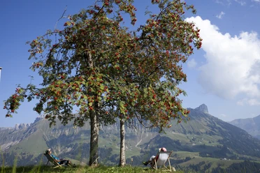
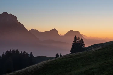
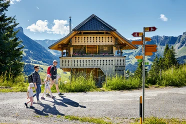
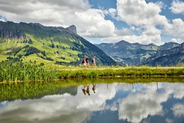
The route continues with a slight ascent over the Hürndliegg to the Hürnli. On this section you are always accompanied by the steeply falling slopes of the Schrattenfluh. No wonder numerous myths and legends circulate around this mountain. At the Hürnli you can enjoy the unique view in peace. The Hürnli hut is located at 1497 m above sea level in the Hilferntal in the municipality of Marbach. It can be rented from the Marbach Ski Club from early June to mid-October. There are several picnic spots and fire sites around the hut.
The storm damage left by the foehn storm in November 2019 is also clearly visible around the Hürnli. The severe winds with peak speeds of 205 kilometers per hour shook the area and damaged around 20,000 trees in the areas Hilfernthal, Hürnli and Steigle in the municipality of Escholzmatt-Marbach.
After a rest, the path now goes up and down towards Schüberlsmoos and then the route runs downhill back to the starting point, the valley station of the Marbachegg ski lifts.
- 4:30 h
- 14.59 km
- 382 m
- 967 m
- 875 m
- 1,533 m
- 658 m
- Start: Valley station, Marbachegg ski lifts
- Destination: Valley station, Marbachegg ski lifts
Good to know
Pavements
Best to visit
Directions
Marbachegg - Chadhus - Imbrig - Steiwang - Hürndli - Schüberlsmoos - Marbach
Tour information
Mountain Railway Tour
Stop at an Inn
Equipment
Good footwear, rain jacket & sufficient drinking water for the way are part of every hike.
Further tips for safe hiking, information about suckler cow herds and livestock guardian dogs and much more can be found on the website of Swiss Hiking Paths.
Directions & Parking facilities
The UNESCO Entlebuch Biosphere is located in the heart of Switzerland, centrally between Bern and Lucerne. You can reach Marbach via main road 10 towards Wiggen. From Thun, you reach Marbach via the Schallenberg.
Plan your route with the help of the Google route planner.
A free parking lot is available at the valley station of the Marbachegg ski lifts.
You can reach Marbach by public transport via Escholzmatt (Bern-Lucerne train line). From Escholzmatt, take the post bus to Marbach "Talstation Marbachegg".
Plan your trip with the SBB online timetable.
Additional information
Escholzmatt-Marbach Tourism
Tourism office Marbach
Dorfstrasse 61
CH-6196 Marbach
Phone +41 (0)34 493 38 04
www.escholzmatt-marbach-tourismus.ch
Author
Escholzmatt-Marbach Tourismus
Organization
UNESCO Biosphäre Entlebuch
Author´s Tip / Recommendation of the author
Start the hike with a mountain breakfast buffet at the Berggasthaus Marbachegg.
Map
The summer panoramic map "Hiking" with many interesting hiking suggestions around Marbach is available at: Escholzmatt-Marbach Tourism

Nearby
