Moorlandschaftspfad Etappe 1: Habkern / Sörenberg


- 5:30 h
- 16.76 km
- 640 m
- 816 m
- 974 m
- 1,594 m
- 620 m
- Start: Sörenberg, Postautohaltestelle Sörenberg, Post
- Destination: Kemmeribodenbad, Postautohaltestelle Kemmeriboden
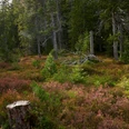
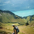
Sharp contrast between the sharp rock of the schrattenfluh and the soft ground of the moor land! The moor landscape is characterized through the extreme contrast between smooth, round forms of the surface of the moor land and the sharp relief of the Schratten-fluh. Big parts of that area are very wild and of nearly intact beauty. On the "Chnubeln" and "Eggen" in the typical location of the moor land, there are traditional alps with deep hang-ing shingle roofs.
Comfortably, you walk on traffic free brash streets through the alpine and Nordic ski area of Soerenberg. The variety of the types of moor land is imposing.
Specials in the moor of the Hilferenpass
S: The moraines by Pfosteregg and Sitenegg count as witnesses of the last ice-age.
T: The hunting ground Tannhorn (ca. 12 km2, 1944 established) presents loads of cham-ois and venison.
U: The fantastic area of Laubersmadghack and Türnliwald is because of the pine bog and the little water areas worth seeing. In the light forests live rare species of animals.
V. The Schrattenfluh attracts attention with typical forms of karst like sinkholes and branched cave systems. In the opposite of the wet moor land, on the bare karst does not exist ground level water because it seeps away belowground through clefts and gaps.
Note(s)
The route is marked with the pointer «Moorlandschaftspfad» and can also be made in the opposite direction.
The starting point Kemmeriboden can bee reached with the bus from the railway station Wiggen. After the tour you can reach the railway station Schuepfheim with the bus
This path can be linked with the Moorlandschaftspfad «Glaubenberg».
See also
Further informations (Brochure «Moorlandschaftspfad» und «Marbach/egg»):
UNESCO Biosphäre Entlebuch
Biosphärenmanagemen
Chlosterbüel 28
CH-6170 Schüpfheim
Telefon: 0041 (0)41 485 88 50
Mail: [email protected]
page: www.biosphaere.ch
Good to know
Best to visit
Directions
- Sörenberg, Post - Abzweigung Rossweid - Salwide - Blatte - Unt. Laubersmad - Arnibergegg - Spierweid - Hinderes Hübili - Kemmeribodenbad
- Die Route ist mit dem Signet «Moorlandschaftspfad» markiert und kann auch in umgekehrter Richtung begangen werden.
- An diese Strecke können die Etappen «Hilferepass» oder «Glaubenberg» angeknüpft werden.
Variante
Gondelbahn Sörenberg- Rossweid: Zeiterspranis 30 Minuten
Informationen zur Gondelbahn finden Sie unter: Bergbahnen Sörenberg
Tour information
Nature Highlight
Stop at an Inn
Equipment
Gutes Schuhwerk und eine allwettertaugliche Ausrüstung sind unerlässlich. Empfehlenswert sind Fernglas, Pflanzen- und Tierbestimmungsbücher, evtl. auch ein Frottetuch, mit dem nach dem Barfusswandern die Füsse getrocknet werden können.
Directions & Parking facilities
Die UNESCO Biosphäre Entlebuch liegt im Herzen der Schweiz, zentral zwischen Bern und Luzern. Mit dem Auto erreichen Sie verschiedenen Etappen über die Hauptstrasse 10.
Planen Sie Ihre Route mit Hilfe des Google Routenplaners.
An den Ausgangsorten hat es diverse kostenlose sowie kostenpflichtige Parkplätze.
Mit dem öffentlichen Verkehr erreichen Sie die verschiedenen Etappen via Bahnlinie Bern-Luzern.
Planen Sie Ihre Reise mit dem SBB Online Fahrplan.
Additional information
UNESCO Biosphäre Entlebuch
Chlosterbüel 28
CH-6170 Schüpfheim
Telefon +41 (0)41 485 42 50
www.biosphaere.ch
Möchten Sie das Moor mit einem Experten erkunden? Gerne organsiert die UNESCO Biosphäre Entlebuch geführte Wanderungen bzw. Exkursionen. Informieren Sie sich beim Biosphärenzentrum: [email protected] oder Tel. +41 (0)41 485 42 50.
Author
UNESCO Biosphäre Entlebuch
Organization
UNESCO Biosphäre Entlebuch
Author´s Tip / Recommendation of the author
Eine grosse Portion "Merängge" im Hotel Kemmeribodenbad ist der krönende Abschluss dieser Etappe.
Safety guidelines
Handy-Empfang ist teilweise schwierig bis unmöglich.
Map
Die Broschüre «Moorlandschaftspfad» mit vielen interessanten Informationen zu den einzelnen Etappen erhalten Sie im Biosphärenzentrum oder können Sie direkt hier bestellen.
Nearby


