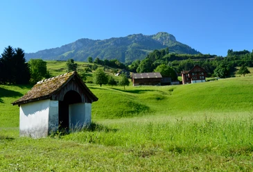
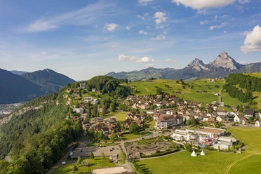
Morschach-Rundi


The beautiful circular path leads from the village square in the village centre towards the forest park. Afterwards, the path leads up to the Axen rock and back again to the village square. Ideal for a relaxing outing with the whole family or a small break from everyday life.
- 0:30 h
- 1.63 km
- 48 m
- 48 m
- 635 m
- 666 m
- 31 m
- Start: Village square Morschach
- Destination: Village square Morschach
Good to know
Pavements
Best to visit
Directions
Information pavilion – Rieten – Forest park – Axen rock - Information pavilion
Tour information
Loop Road
Stop at an Inn
Directions & Parking facilities
Coming from Basel-Lucerne:
From Lucerne, take the A14 towards Zug. After 20 km you reach the Rütihof motorway junction. There, take the A4 motorway towards Schwyz. At Brunnen, the motorway ends in a dual carriageway. Stay on this route towards Gotthard / Morschach. After the 1.1 km long Mosi tunnel, 500 m later turn left off the dual carriageway towards Morschach.
Coming from Lake Constance and Rapperswil:
At Rapperswil, drive towards Pfäffikon / Gotthard. At Pfäffikon, briefly take the A3 motorway towards Gotthard. Immediately take the first exit towards Gotthard / Schwyz again. The country road leads you over Rothenthurm and Sattel to Schwyz. At Schwyz, take the bypass T8 and join the A4 motorway towards Gotthard / Brunnen. At Brunnen, the motorway ends in a dual carriageway. Stay on this route towards Gotthard / Morschach. After the 1.1 km long Mosi tunnel, 500 m later turn left off the dual carriageway towards Morschach.
Coming from Gotthard-Altdorf:
Take the bypass (tunnel) near Flüelen towards Schwyz. 500 m before Brunnen, turn right towards Morschach. GPS-
Morschach is located on a sunny plateau above Lake Lucerne. The village can be reached by public transport from Brunnen with line 504 of Auto AG Schwyz.
Author
Stoos-Muotatal Tourismus
Organization
Stoos-Muotatal Tourismus

Nearby


Download GPX file