Obwalden High Trail: Stage 3

The third stage of the Obwalden High Trail is rather short at around two and a half hours. It begins with a gentle ascent, followed by a long descent of over 1,000 meters in altitude.
The start is at the Schönbüel mountain inn. You can also spend the night here and enjoy the special atmosphere in the evening or morning. The view of the surrounding mountains is impressive.
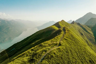
The trail leads below the Höch Gumme to the Gibel viewpoint. From here, you can see deep down to Lake Brienz and Lake Thun. The high peaks of the Bernese Oberland and the mountains of Central Switzerland are also clearly visible.
This is followed by a beautiful ridge hike. The path runs over the Scheidegg and below the Wilerhorn. If you still have energy left, you can climb the Wilerhorn and enjoy the view from the summit.
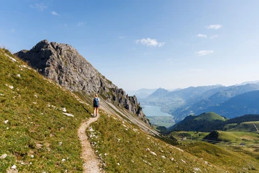
The trail then descends across meadows and through open terrain towards Maiensäss Wiler. At Schäriwald, the hiking trail turns into a gravel road. Passing Älpeli, you finally reach the Brünig Pass at 1002 meters.
The Brünig has been an important crossing point between Central Switzerland and the Bernese Oberland for centuries. Even in earlier times, a trade route led south here. Today, trains and cars cross the pass all year round.
- 2:27 h
- 7.34 km
- 34 m
- 1,039 m
- 1,001 m
- 2,040 m
- 1,039 m
- Start: Bärghuis Schönbüel
- Destination: Brünig Pass
Good to know
Best to visit
Author
Obwalden Tourismus
Organization
Obwalden Tourismus
Author´s Tip / Recommendation of the author

Nearby