Path of Switzerland – Stage 2: Bauen - Flüelen


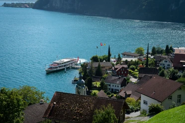
After the village of Bauen, you reach a romantic path along the lake. It takes you through various galleries with fireplaces to the boat station in Isleten. Due to acute rock hazard, the path runs through the road tunnel over the last 400 meters. In Isleten, you can take the post bus to Isenthal and Altdorf. Or you continue hiking directly along Lake Uri on a flat path to Seedorf. Halfway there, you see the Bolzbach power plant, where water from Isenthal is converted into electricity.
Shortly before Flüelen, the path turns left into the nature reserve at the Reuss delta. Now you have the choice: either follow the path along the lake, or go directly through the nature reserve. Both paths lead you to the Reuss, which you cross via a wooden bridge. Finally, the further path leads you directly to the train, bus, and boat station at Flüelen on the lake.
- 2:25 h
- 10.06 km
- 22 m
- 20 m
- 434 m
- 452 m
- 18 m
- Start: Bauen
- Destination: Flüelen
Good to know
Pavements
Best to visit
Directions
Tour information
Barrier-Free
Cultural Interesting
Nature Highlight
Stop at an Inn
Tour with Dog
Equipment
Hiking shoes with good tread or trekking shoes, rain jacket, drink, provision, possibly poles.
Directions & Parking facilities
The motorway from Lucerne leads via the Flüelen exit towards Seedorf to Bauen.
The motorway from Zurich leads via Axenstrasse towards Altdorf/Seedorf to Bauen.
There are few parking spaces available in Bauen.
Parking lot Flüelen station – Bahnhofstrasse 1 – 6454 Flüelen
P+Rail Flüelen – Bahnhofstrasse 3 – 6454 Flüelen
Boat. Most visitors come to Bauen by boat. The boat trip from Flüelen and Brunnen takes only between 20 and 25 minutes. Boats run regularly. If you want to enjoy a longer boat trip, you can board the boat already in Lucerne. Exact departure times and information about round trips can be found here: www.lakelucerne.ch
Train and bus. From Zurich and Lucerne, the train runs hourly and half-hourly to Flüelen. Also from Ticino. From Flüelen station to Bauen, take the bus to Altdorf, Telldenkmal and change with a short walk to the post bus at the Altdorf, Post stop. The final stop is Isleten Seegarten, from where you hike about 20–30 minutes to Bauen. www.sbb.ch
Alternatively, the Tellbus runs from Lucerne station with few stops to Altdorf, Telldenkmal. From the Flüelen, Eggberge valley station stop, it is about a 15-minute walk to the Flüelen boat station. www.aagu.ch
Additional information
The route Bauen – Isleten – Seedorf – Flüelen is pram- and wheelchair-accessible.
The Path of Switzerland is based on a farsighted vision: It should be an example of gentle interaction with nature and remain a modest place of encounter. The mountains, the lake, and the magnificent views remain its defining elements to this day.
Learn everything about the Path of Switzerland at www.wegderschweiz.ch
On the Path of Switzerland you hike through the homeland of Wilhelm Tell. Along the way, you meet witnesses of history and encounter hero myths. You can engage with various images of Switzerland and rediscover your own picture of Switzerland.
Learn everything about the experience region «Cradle of Switzerland» at www.wiegederschweiz.ch
Literature
Cultural landscape guide, Around Lake Lucerne. Waldstätterweg & Path of Switzerland. 2nd edition.
ISBN 978-3-03818-334-1
Author
Jonas Ulrich
Organization
Schwyzer Wanderwege
Author´s Tip / Recommendation of the author
Highlights
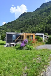
- Zwyssighaus in Bauen
- Nature reserve “Reuss delta”
- Bathing islands “Lorelei”
- Castle Rudenz in Flüelen
Additional variant: Bauen–Isenthal–Isleten
Sporty variant on the old land connection between the cantons of Nidwalden and Uri. Ascent and descent over boldly designed mountain paths with attractive viewpoints. In between, a tranquil valley hike in the secluded Isenthal.
Map
Hiking map «Path of Switzerland» 1:25 000 / Federal Office of Topography, Swisstopo.
ISBN 978-3-302-32599-6

Nearby


