Snowshoe trail 897: Gitschenen, Isenthal


Hiking in the snowy mountain world is an experience. With a bit of luck, you can observe deer, chamois or snow hares. Night owls also get their money's worth: the route can also be done by full moon. The route leads from the cable car to the mountain station of the ski lift, then to Rüteli and the front Schrindi. From there it is only a few meters to the viewpoint. The path leads back through the forest to the ski lift. The route is also suitable for beginners and takes about 1.5 hours covering 2.3 km.
- 1:34 h
- 3.63 km
- 255 m
- 251 m
- 1,387 m
- 1,595 m
- 208 m
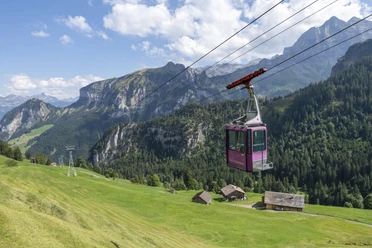
- Start: Mountain station aerial cableway Isenthal-Gitschenen
- Destination: Mountain station aerial cableway Isenthal-Gitschenen
Good to know
Pavements
Best to visit
Directions
Tour information
Familiy-Friendly
Loop Road
Stop at an Inn
Equipment
Directions & Parking facilities
Author
Markus Fehlmann
Organization
Verein Urner Wanderwege
Author´s Tip / Recommendation of the author
Safety guidelines
Map
Nearby
Download GPX file