Spannorthütte SAC


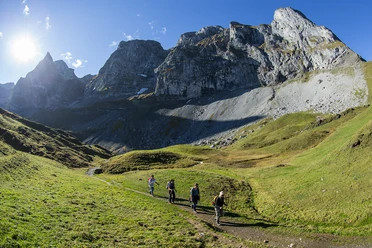
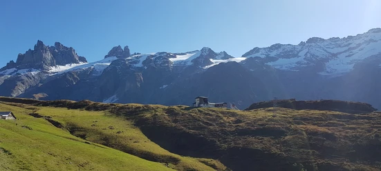
From the entrance to the wild romantic Suren Valley, the hiking trail winds diversely along the Engelberger Aa. After a short break at Alp Stäfeli, the previously comfortable path turns into an alpine trail that requires surefootedness. Arriving at the cozy SAC hut, you ask yourself: stay overnight, enjoy a beautiful sunset, or hike back (the same way).
- 4:30 h
- 10.92 km
- 961 m
- 1,000 m
- 1,961 m
- 961 m
- Start: Engelberg train station
- Destination: Spannorthütte SAC
Good to know
Pavements
Best to visit
Directions
Engelberg train station - valley station Fürenalp - Alpenrösli - Alp Stäfeli - Spannorthütte SAC
Tour information
Stop at an Inn
Equipment
Sturdy hiking shoes are required. Sun protection and hiking poles, as well as a small snack, are advantageous.
Directions & Parking facilities
By car you drive on the A2 (Basel-Gotthard) to Stans Süd, then on the main road 20 km to Engelberg. Engelberg is 30 minutes from Lucerne, 1 hour and 15 minutes from Basel, Zurich, or Bern.
Parking spaces are available in Engelberg for a fee. Parking options
National and international connections (from Zurich Airport, connections every half hour with approx. 1h travel time) to Lucerne. Then by Zentralbahn in 43 minutes through varied landscapes and gorges up to Engelberg.
Additional information
Author
Engelberg - Titlis Tourismus
Organization
Engelberg-Titlis Tourismus
Author´s Tip / Recommendation of the author
At Alp Stäfeli you will be served with traditional Swiss dishes and a fine "Älpler-Kafi".
Safety guidelines

Nearby