Walenstöcke circuit


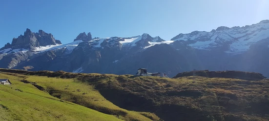
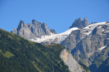
In about 30 minutes walking you reach the Älplerbeizli Rigidal. The ascent continues to the Rugghubelhütte (2290 m above sea level) and up to the Rot Grätli (2559 m above sea level), the highest point of the circuit. Behind the Rot Grätli there is sometimes still snow in midsummer. Continuing over the Bannalper Schonegg (2250 m above sea level) it goes down to the Urnerstafel by the Bannalpsee (1690 m above sea level). There you face the ascent to the Walegg (1951 m above sea level). Then down to the Walenalp (1675 m above sea level) and back over the Stock or Rosenbold to Ristis.
- 9:10 h
- 24.54 km
- 1,570 m
- 1,569 m
- 1,593 m
- 2,559 m
- 966 m
- Start: Ristis
- Destination: Ristis
Waypoints
Good to know
Pavements
Best to visit
Directions
Ristis – Rigidal – Rugghubel – Rot Grättli – Bannalper Schonegg – Bannalp - Ristis
Tour information
Loop Road
Stop at an Inn
Directions & Parking facilities
There is a large paid parking lot available at the Brunni-Bahnen Engelberg.
Additional information
For tourist information: Nidwalden Tourism
Author
Nidwalden Tourismus
Organization
Nidwalden Tourismus
Author´s Tip / Recommendation of the author
The hike can alternatively be done as a leisurely two-day route. The following six overnight accommodations are available along the route:
- Berglodge Restaurant Ristis
- Brunnihütte SAC
- Rugghubelhütte SAC
- Mountain inn Urnerstaffel
- Mountain inn Bannalpsee
Safety guidelines
The Walenstöcke circuit is a demanding hike. Due to snowfields that lie behind the Rot Grätli depending on the season, good footwear is essential. Very good fitness is required. The circuit can be started no earlier than July (depending on snow conditions).

Nearby


Download GPX file