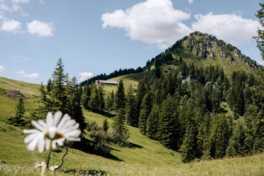
Unteriberg cultural route


At 9 information panels on the circular route, historical and cultural information about the municipality of Unteriberg is presented. For variety, you can also learn legends from the Ybrig region. The information is rounded off with explanations of place names and expressions in the Ybrig dialect.
- 1:45 h
- 6.24 km
- 104 m
- 104 m
- 897 m
- 1,001 m
- 104 m
- Start: Guggelsstrasse Unteriberg (near hotel and Minster indoor swimming pool), free parking
- Destination: Guggelsstrasse Unteriberg
Good to know
Pavements
Best to visit
Directions
You start from the Minster parking lot on Guggelsstrasse towards Waagtalstrasse. Continue past the Herti school, along the Minsterbach to the Red Bridge where the first information panel is located.
Continue mainly along the "Minster", over the Schmalzgrubenried, Allmigli, across the cantonal road to Alte Gasse up to Brenten, where you can learn a lot from the further panels.
Cross the suspension bridge towards Höchgütschwald up to the so-called Schafbadi, where the last information panel of the cultural route is located.
Return to the starting point via Höchgütschstrasse.
Tour information
Cultural Interesting
Loop Road
Equipment
Directions & Parking facilities
Additional information
Author
Einsiedeln-Ybrig-Zürichsee Tourismus
Organization
Region Ybrig
Author´s Tip / Recommendation of the author

Nearby

Download GPX file