- Photos & Map
How would you like to arrive?
- Description
- Good to know
- Nearby
- 4:30 h
- 10.67 km
- 1,013 m
- 1,013 m
- 2,028 m
- 2,961 m
- 933 m
- Start: Vermigelhütte SAC
- Destination: Gemsstock
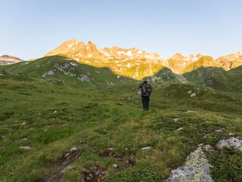
From the Vermigelhütte in the Unteralptal, the white-blue marked path leads to the ground of Sunnsbiel via the Gafallenstafel (2334 m above sea level) to the alpine meadows of Gafallen, where small lakes line the path. Over snowfields, scree, and rock ridges, the path rises to the Schwarzbach and over a steep rubble field further up to Gemsstock. Once at the top, you take the same path back.
Thousands of freeriders descend from Gemsstock every winter on various routes through the Unteralptal to Andermatt. In summer, there are significantly fewer people taking the marked path over Gafallen.
Good to know
Pavements
Best to visit
Directions
Tour information
Summit
Equipment
- Clothing appropriate for the weather
- Good footwear
- Hiking poles are recommended
- Camera
- Day backpack
Directions & Parking facilities
Additional information
- Note: The aerial cableway to Gemsstock is not in operation during summer.
- For further questions, please contact: Ferienregion Andermatt, +41 41 888 71 00, [email protected]
Author
Andermatt-Urserntal Tourismus GmbH
Organization
Région de vacances Andermatt
Author´s Tip / Recommendation of the author
- Overnight stay at the Vermigelhütte
- Ride with the call taxi MyBuxi or with your own car with a driving permit from the corporation via Parkingpay
Safety guidelines
- This is an alpine hiking trail and therefore requires sure-footedness.
Hikers should watch the weather forecast in advance, as the hike partly takes place above 2000 m above sea level and thus, in extreme cases, light snowfall can occur.
Nearby


