Waterfall circular route

The route should not be underestimated despite its short length, as the ascent along the Stäubi involves rough terrain. Above the waterfall, the Trübseebach is crossed in flatter terrain and the mountain hiking trail leads back to the starting point.
- 0:50 h
- 2.52 km
- 154 m
- 154 m
- 1,764 m
- 1,918 m
- 154 m
Waypoints
Good to know
Pavements
Unknown (39%)
Trail (61%)
Best to visit
suitable
Depends on weather
Tour information
Loop Road
Equipment
- Sturdy footwear is recommended
- Observe weather conditions
Literature
None
Author
Engelberg - Titlis Tourismus
Organization
Engelberg-Titlis Tourismus
Author´s Tip / Recommendation of the author
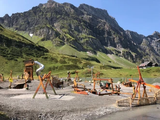
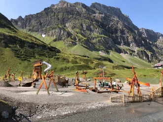
The smuggler's playground at the starting point is a must for every family!
Safety guidelines
- Solid footwear is recommended
- Take note of weather conditions
Map
1191 Engelberg

Nearby


Download GPX file