4-Lakes Bike Route «Route +» in Engelberg


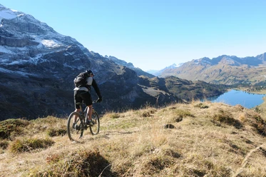
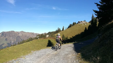
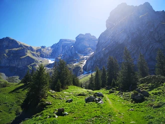
From Engelberg station, the starting point of the 4-Lakes Bike Route+, you ride to the valley station of the TITLIS cable car and then left over the paved Gerschnistrasse (construction traffic is to be expected on the road) towards Untertrübsee. Passing the Alp Untertrübsee, a gravel path branches off to the left after about one kilometer. Strong legs are required from here on. The coarse gravel demands high fitness and riding technique. The view of the Titlis and the knowledge that you can continue up with the chairlift lets you forget the effort. The approximately 400 meters of altitude from Trübsee to the Jochpass can be covered by chairlift. From here, you follow a beautifully laid out single trail (1 meter path width) towards Engstlensee. Need a short break? Tired biker feet can cool down and relax here. After passing the lake, there is a push passage of about 600 meters along the Spycherflue up to Tannalp. Now you ride on a wide paved road along the deep blue Tannalpsee and beautiful alpine meadows, gently downhill towards Melchsee. Upon reaching Melchsee-Frutt, you continue via the Melchtalerstrasse to Stöckalp. This road is only passable downhill at odd hours (e.g., 11:00-11:40). Through the Melch valley, past St. Niklausen to Kerns, you are on the main road. In the village center of Kerns, follow the road toward Stans. Upon reaching the idyllic village center of Stans, recharge your batteries before the return trip to Engelberg preferably at the gelateria. Up to the junction before the railway crossing, you cover a short section on the main road. Just by the small chapel, turn right onto the bike path. Along the Engelberger Aa, the path gently climbs to Grafenort. From here, the surface changes to gravel. The narrow gravel path winds idyllically up and down along the water up to a beautiful fireplace. Time for a snack from your backpack, because from now on strong legs are required. Short breaks are only provided by the numerous bridges on the way back to Engelberg. Once the first houses of the locality are reached, you have conquered the altitude and it goes downhill to Eugenisee. Back to the station and the starting point of the route, the last few meters follow again on the main road.
- 9:10 h
- 72.61 km
- 1,983 m
- 1,976 m
- 445 m
- 2,207 m
- 1,762 m
- Start: Engelberg station
- Destination: Engelberg station
Waypoints
Good to know
Pavements
- Street (34%)Asphalt (29%)Gravel (11%)Trail (14%)Path (10%)Lift (2%)
Best to visit
- suitableDepends on weather
Directions
- Engelberg-Untertrübsee-Trübsee-Jochpass-Engstlen-Tannalp-Melchsee-Frutt-Stöckalp-Melchtal-St.Nikolaus-Kerns-Stans-Dallenwil-Wolfenschiessen-Grafenort-Engelberg
Tour information
Cable car tour
Circular trail
Refreshment stop
Equipment
The bike shops in Engelberg offer a wide range of bikes and accessories for rent and purchase. It's also worth stopping by for repairs and spare parts.
Directions & Parking facilities
- Getting thereBy car, take the A2 (Basel-Gotthard) to Stans South, then on the main road 20 km to Engelberg. Engelberg is 30 minutes from Lucerne, 1 hour and 15 minutes from Basel, Zurich, or Bern.ParkingParking is available in Engelberg for a fee.Public transportationNational and international connections (from Zurich Airport, connections every half hour with about 1-hour travel time) to Lucerne. Then with the Zentralbahn in 43 minutes through a varied landscape and gorges up to Engelberg.
Additional information
Author
Engelberg - Titlis Tourismus
Organization
Engelberg-Titlis Tourismus
Author´s Tip / Recommendation of the author
- Multi-day stage with overnight stay and train usage
Safety guidelines
In the shoulder season, snowfalls are to be expected above 2000 meters
On the road between Gerschnistrasse and Untertrübsee, construction traffic is to be expected.
The Melchtalerstrasse leading to Stöckalp is only passable downhill at odd hours (e.g., 11:00-11:40).
Push passage of about 600 meters along the Spycherflue up to Tannalp.
Nearby





Download GPX file