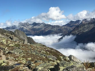
5-hut panoramic route: Stage 5 Voralphütte SAC to Salbithütte SAC


The 5th stage of the 5-hut panoramic route starts at the Voralphütte and leads to the Salbithütte. Behind the Voralphütte, follow a steep path towards Chüeplanggenstock up to the Flüestafel. Here the white-blue-white marked route turns southeast, ascends over the steep couloir of the Chüeplanggenchelen to below the ridge spur of the Rothorn. In rocky terrain, it goes down to the Horefelliboden. Then follows a steep rock step – it is overcome descending many rungs of a 50-meter-high metal ladder. Hikers cross the via ferrata secured with steel cables. After a mountainous terrain basin, there is another ladder. The path winds steeply up to the ridge hump below the Salbitschijen west ridge. Through the following scree slope, the route passes the bivouac box up to a short metal ladder. Over its rungs, you climb down to the Salbit bridge, which crosses the Stotzig-Chälä in a Nepalese style.
- 3:00 h
- 7.14 km
- 602 m
- 621 m
- 2,083 m
- 2,541 m
- 458 m
- Start: Voralphütte SAC
- Destination: Salbithütte SAC
Good to know
Pavements
Best to visit
Directions
Tour information
Nature Highlight
Stop at an Inn
Equipment
- Weather-appropriate clothing
- Good footwear
- Hiking poles are recommended
- Via ferrata set required (entire 5-hut route)
Directions & Parking facilities
You reach the Göscheneralp valley via Göschenen. Göschenen is located directly at the A2 motorway exit.
There are parking spaces directly at the Göscheneralp reservoir.
You can reach the Göscheneralp valley, where both huts are located, by bus. The timetable is as follows: Postbus Timetable and the stops are "Voralphütte" or "Salbit".
Additional information
Author
Andermatt-Urserntal Tourismus GmbH
Organization
Région de vacances Andermatt
Author´s Tip / Recommendation of the author
- Advance reservation of the huts is recommended
- Rental of a via ferrata set is possible at the Voralp and Salbit huts
Safety guidelines
- Risk of slipping in May and June due to old snow
Hikers should keep an eye on the weather forecast in advance, as parts of the hike are above 2000 m (6562 ft) and in extreme cases there may be light snowfall.

Nearby

