A high-altitude hike (multi-day route)


Around the Stanserhorn to Wirzweli (overnight stay). The next day on the panoramic route above the Engelberg valley via Diegisbalm to Bielen and down to the valley by cable car to Grafenort.
- 8:15 h
- 23.20 km
- 1,550 m
- 1,432 m
- 517 m
- 1,567 m
- 1,050 m
- Start: Allweg, Ennetmoos
- Destination: Grafenort
Good to know
Pavements
Best to visit
Directions
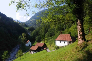
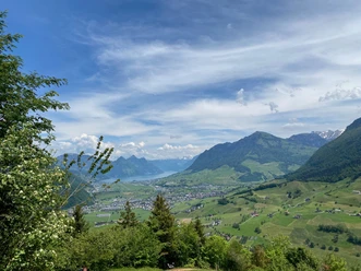
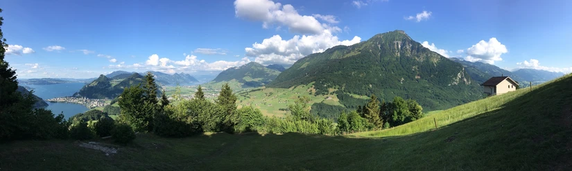
At the beginning, we more or less circle around the Stanserhorn. The start of this multi-day route is the Allweg chapel. On forestry paths and through the forest, we reach Bluematt and via Ahornhütte in a large zigzag the Blatti on the Stanserhorn ridge. Then it goes down steep meadows 500m to the Wiesenberg. In the Wirzweli area, there are various overnight accommodation options. The next morning is less strenuous; on the high-altitude hike above the western Engelberg valley, we reach Diegisbalm and Bielen. The aerial cableway finally takes us down to the valley; it is half an hour to the Grafenort station of the Zentralbahn.
The time calculation takes into account the descent by the Bielen cable car.
Additional information
For tourist information:
Nidwalden Tourism
Bahnhofplatz 2
6370 Stans
+41 (0)41 610 88 33
More routes at nidwalden.com/wandern
Author
Nidwalden Tourismus
Organization
Nidwalden Tourismus

Nearby