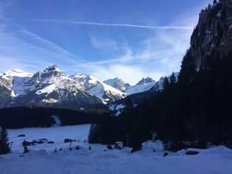
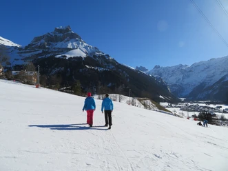
Across the monastery meadow to Horbis

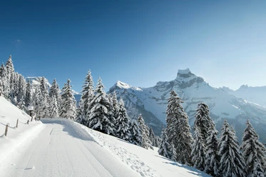
From Engelberg station, go through Dorfstrasse past the Tourist Information always towards the monastery. There, to the left in front of the monastery church, take the stairs up. The path then leads across the snowy monastery meadow, where the little guests make their first attempts on skis. At the other end, the path leads left down into the valley. Through the Grotzenwäldli, past the Robinson playground to the very back. Arriving at Horbis, the restaurant End of the World invites you to a hot drink and a break.
- 0:56 h
- 3.12 km
- 130 m
- 1,000 m
- 1,130 m
- 130 m
- Start: Engelberg station
- Destination: Horbis
Waypoints
Good to know
Best to visit
- suitableDepends on weather
Directions
- Engelberg station - Heimat - Horbis
Tour information
Refreshment stop
Equipment
- High and sturdy hiking boots or winter boots, warm clothing, sun protection, trekking poles recommended.
Directions & Parking facilities
- Getting thereBy car, take the A2 (Basel-Gotthard) to Stans South, then follow the main road 20 km to Engelberg. Engelberg is 30 minutes from Lucerne, 1 hour and 15 minutes from Basel, Zurich or Bern.ParkingParking is available in Engelberg for a fee.Public transportation
National and international connections (from Zurich Airport connections every half hour with about 1 hour travel time) to Lucerne.
Then take the Zentralbahn in 43 minutes through varied landscapes and gorges up to Engelberg. The combination with the boat is also appealing: from Lucerne by lake to Beckenried and from there by public bus and train to Engelberg
Additional information
Author
Engelberg - Titlis Tourismus
Organization
Engelberg-Titlis Tourismus
Author´s Tip / Recommendation of the author
- Stopover at the rustic restaurant End of the World.
Safety guidelines
Please check the winter sports report on engelberg.ch when planning, which indicates whether the winter hiking trails are groomed and open.