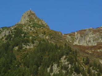
Adventure Trail Gurtnellen


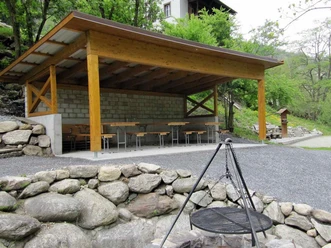
Along the Gottardo hiking trail there are nine information boards. They convey much interesting and educational information about the biodiversity of the Urner Reusstal. Each board is dedicated to a specific topic, such as water, forest, or animals. The Felliboden rest area invites you to linger and enjoy.
There are several possible starting points for the hike along the Gurtnellen-Wiler adventure trail. Depending on arrival and desired length, basically any point along the Gottardo hiking trail can be chosen. The nine stations along the trail are located on the section between Gurtnellen-Wiler and the Felliboden viewing platform. More information can be found at: Adventure Trail Gurtnellen
- 3:40 h
- 5.21 km
- 128 m
- 128 m
- 674 m
- 739 m
- 65 m
- Start: Gurtnellen Wiler
- Destination: Gurtnellen Wiler
Good to know
Pavements
Best to visit
Directions
Tour information
Cultural Interesting
Nature Highlight
Stop at an Inn
Tour with Dog
Equipment
- Weather-appropriate clothing
- Good footwear
- Day backpack
- Camera
Directions & Parking facilities
Gurtnellen is well connected through the cantonal road of the canton Uri with the motorway A2. The nearest motorway exits are Wassen and Amsteg.
In the lower village part ‘Gurtnellen Wyler’ or along the cantonal road, there are various parking options including display spaces.
You can reach the starting point Gurtnellen directly by bus from Göschenen or Altdorf. The timetable is as follows: Timetable Auto AG Uri
Additional information
Author
Andermatt-Urserntal Tourismus GmbH
Organization
Région de vacances Andermatt
Author´s Tip / Recommendation of the author
- Play and adventure area Gurtnellen
- Felliboden suspension bridge
- Ideal for families
Safety guidelines
Nearby