Along the Wyna to Beromünster


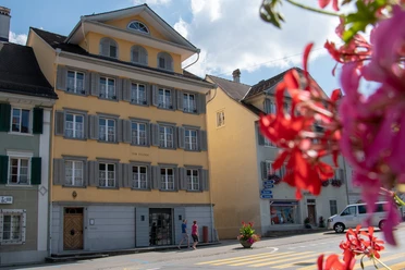
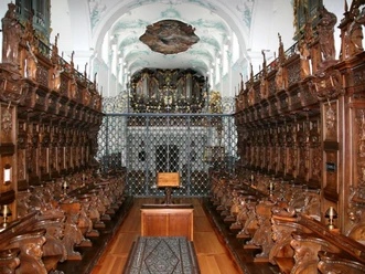
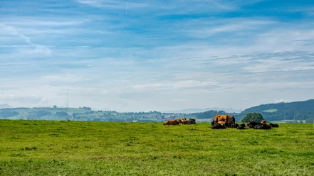
The start of this hike is the terminus of the AAR in Menziken, from where we walk through the village to the bathing area. There we meet the Wyna and then follow it all the way to Beromünster. The Wyna was greatly widened in the 1990s so that debris can deposit during flooding, as in 1994, when it was still canalized, it flooded the villages downstream. We go under the bridge of the former "Möischterlinie" of the SBB, which is now a bike path. The hamlet of Wynon is already part of Beromünster, which includes numerous other districts. The path continues through a forest and along the riverbank, always on traffic-free paths. Soon we reach Beromünster, where we can already see the tower of the monastery from afar. Through the medieval village, we soon reach it. A look inside is worthwhile.
- 1:30 h
- 5.87 km
- 106 m
- 5 m
- 547 m
- 653 m
- 106 m
- Start: Menziken, AAR station
- Destination: Beromünster, bus station
Good to know
Best to visit
Directions
Tour information
Cultural Interesting
Equipment
Directions & Parking facilities
Outbound: From Aarau with the AAR to Menziken
Return: By bus from Beromünster back to Menziken
Additional information
Author
Tourenplaner SCHWEIZ
Organization
Tourenplaner SCHWEIZ
Author´s Tip / Recommendation of the author
Map
Nearby