Biberegg-Herrenboden snowshoe trail


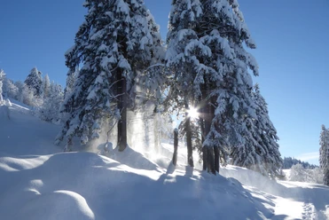
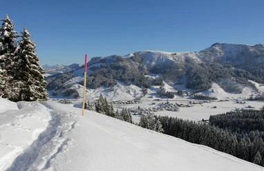
After Biberegg, you cross an idyllic bridge and the little Steiner Aa stream. Soon you enter a small fairy-tale forest. Well warmed up, the path steadily climbs uphill. You can take a break along the way; if you turn around, you can enjoy the wide view over the Rothenthurm raised bog, the largest contiguous raised bog area in Switzerland. The path continues over snowy meadows to Spilmettlen. The most demanding section is now done, and the impressive panoramic view over the Ägerital, the Schwyz basin, the Rigi, and Lake Lucerne rewards you for these efforts.
A short descent brings you to Herrenboden, and shortly after, another highlight awaits: the Skywalk, one of Europe's longest pedestrian suspension bridges at 374 meters, offers an unforgettable experience for those who are not afraid of heights. Those who prefer to skip the bridge simply continue walking. After a final small ascent, the path gently slopes downward to Mäder, where the circle closes and you return to Biberegg on the familiar path.
- 5:20 h
- 10.35 km
- 640 m
- 640 m
- 958 m
- 1,474 m
- 516 m
- Start: Biberegg chapel
- Destination: Biberegg chapel
Good to know
Best to visit
Directions
Biberegg chapel 942 m asl - Geissgütsch 1100 m asl - Bannegg 1440 m asl - Herrenboden 1178 m asl - Halsban 1244 m asl - Geissgütsch 1100 m asl - Biberegg chapel 942 m asl
Equipment
Snowshoes, poles, hiking backpack, weather-appropriate clothing
Directions & Parking facilities
Follow the road from Schwyz or Arth Goldau towards Rothenthurm.
Parking available at Biberegg station or in Rothenthurm.
Take the train or bus to Biberegg. Possible from Arth Goldau, Rothenthurm, and Biberbrugg.
Check the timetable here: sbb.ch
Additional information
Switzerland Mobility Route 815, more information can be found here.
Author
Erlebnisregion Mythen
Organization
Schwyzer Wanderwege

Nearby