Chli Bielenhorn

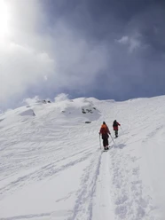
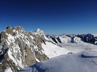
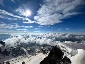
Chli Bielenhorn is a small but fine, frequently visited ski and snowshoe route destination amidst rugged granite peaks and steep glaciers. You have impressive rock walls behind you and a beautiful view into the summit world of the Gotthard area. The route starts in Realp and leads uphill along the Tiefenbach near Alp Tiefenbach to the Tiefen glacier. From there, it goes left uphill to Chli Bielenhorn.
- 4:10 h
- 15.79 km
- 1,377 m
- 1,377 m
- 1,546 m
- 2,924 m
- 1,378 m
- Start: Realp
- Destination: Realp
Good to know
Best to visit
Directions
Realp - Tiefenbach - Tiefen glacier - Chli Bielenhorn - Furka road - Tiefenbach - Realp
Tour information
Loop Road
Nature Highlight
Stop at an Inn
Equipment
Ski touring equipment
Warm clothing
Helmet
Food supplies
Avalanche equipment
Offline map, GPS
Directions & Parking facilities
The starting point Realp is conveniently reachable by car from Andermatt or via the Furka car shuttle.
Day parking is available in front of the village (MGB area / Grotto Stella d'Oro) as well as on the village square. These can be used for a fee between 6 AM and midnight. More information is available from the Realp municipality.
The starting point Realp is conveniently accessible by the Matterhorn Gotthard Railway. You can find the current timetable at: www.sbb.ch.
Additional information
If you have further questions, feel free to contact: Andermatt holiday region, +41 41 888 71 00, [email protected]
Author
Andermatt-Urserntal Tourismus GmbH
Organization
Région de vacances Andermatt
Author´s Tip / Recommendation of the author
Visit to Tiefenbach for a snack
Safety guidelines
Before starting the route, be sure to check the avalanche bulletin and inform yourself about the local conditions.
Nearby
Download GPX file