Circular hike Luthern - Ober Scheidegg


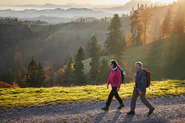
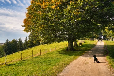
From the village, we quickly gain elevation and are soon rewarded with a beautiful view. On alpine paths, we reach the ridge along which the border trail runs. Those who wish can make a detour to the well-known viewpoint Ahorn, about 20 minutes away, where you can be well catered for at the Ahornalp mountain restaurant. Our varied path leads southward toward Napf. Along the way, we also pass the well-equipped barbecue site "Seppi a de Weggere," dedicated to the well-known folklorist Josef Zihlmann. At the Alp Ober Scheidegg, we leave the border trail and begin the descent, which leads us through alpine pastures and wooded sections. Passing stately farms, we reach the valley floor and soon the village of Luthern.
- 4:00 h
- 12.35 km
- 561 m
- 561 m
- 769 m
- 1,212 m
- 443 m
- Start: Luthern Dorf
- Destination: Luthern Dorf
Good to know
Pavements
Best to visit
Directions
Luthern-Nesslisboden-Chatzerschwand-Höchschwändi-Ober Scheidegg-Gross Scheidegg-Ober Hirsenegg-Luthern
Tour information
Loop Road
Equipment
- Clothing appropriate for the weather
- Good footwear
- Trekking poles are recommended
- Camera
- Daypack
Directions & Parking facilities
Parking spaces are available
From Zell station by post bus to Luthern Dorf
Additional information
How's the weather? Here you can access the webcams.
Author
Willisau Tourismus
Organization
Willisau Tourismus
Author´s Tip / Recommendation of the author
- The cozy Country Inn Krone with garden seating in the center of Luthern
- Napf-Chäsi Luthern with regional specialties
Map
Nearby

Download GPX file