Circular hike Nebikon - Santeberg


Our route takes us from Nebikon station to the south slope of the Santeberg, where we soon reach the signpost “Santeberg South” on a pleasant forest path with steep hairpin bends. From there we turn north towards the hiking sign “Santeberg North” and from there hike on the well-marked national hiking route "Via Gottardo" 7 through the forest towards Lättloch and further towards Chätzigerhöchi.
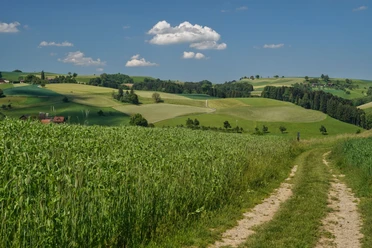
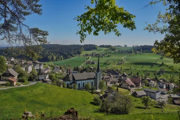
From there, the first nice panoramic views already open up. Be careful, there are two different signposts “Chätzigerhöchi”! At the first signpost at 699m we continue on the “Via Gottardo” towards St. Erhard, and only at the second signpost at 685m do we turn towards “Ängelberg.” Through a forested section, the path descends steeply to the farms of the hamlet Ängelberg. From there, the path runs pleasantly but partly sun-exposed along the forest. Time and again, a wonderful view opens up over the Wauwilermoos plains, the Alps and the foothills of the Napf. En route we pass two barbecue sites which invite you to linger. Mostly on forest roads, the path leads back to Nebikon.
- 2:30 h
- 9.31 km
- 220 m
- 220 m
- 483 m
- 700 m
- 217 m
- Start: Nebikon station
- Destination: Nebikon station
Waypoints

Good to know
Pavements
Best to visit
Directions
Nebikon - Rüsle - Santeberg - Chätzigerhöchi - St. Erhard - (If additional loop: Berg - Ängelberg - Wauwil) - Egolzwilerberg - Nebikon
Tour information
Loop Road
Equipment
- Clothing suitable for the weather
- Good footwear
- Hiking poles are recommended
- Camera
- Day backpack
Directions & Parking facilities
Additional information
The Santenberg ridge was formed as a glacial moraine in the last ice age.
Author
Willisau Tourismus
Organization
Willisau Tourismus
Author´s Tip / Recommendation of the author
The 30-minute additional loop to the hamlet of Schönbühl is worthwhile for the nice view, but mostly runs sun-exposed over asphalt.
Map
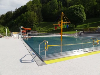
Nearby

Download GPX file