Circular hike Sachseln - Flüeli-Ranft - Sachseln


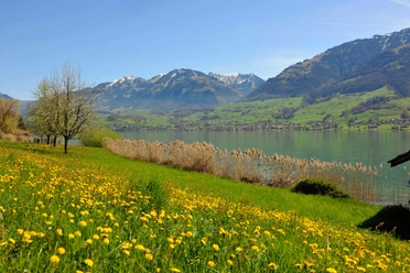
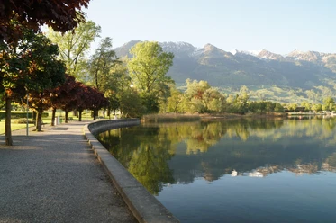
The hike starts at Sachseln railroad station. After 200 meters in an easterly direction, you reach the Wissibach and follow the "Hohe Brücke" signposts. At Blattigässli, the path climbs to Salzbrunnenbrücke and on to Schafbad beiSandloch. Turn left there, cross Flüelistrasse and reach the Chalchofen forestry yard. A public WC is available here. Shortly before Peter RohrerWanderleiter the forestry yard, you turn right and reach Polenstrasse. This was built during the Second World War by the interned Polish soldiers of the Second Rifle Division. Via Melchaabord, high above the Große Melchaa, you reach the Hohe Brücke bridge, which connects the municipalities of Kerns and Sachseln 100 meters above the watercourse. The special hiking trail continues to Flüeli-Ranft. Here you have earned a break and can fortify yourself in several restaurants. Following the signs to Ifang and then Firstli Höchi, you reach the unknown, fantastic Schluecht viewpoint. The highest point of the hike is at "Firstli-Gädäli", from where the trail descends towards Lanzenbüel, Riedmatte and Churigen back to Sachseln. Shortly before Sachseln, at Rüteli, you should not miss the Vision 6 display with its unique view of Sachseln. The last section of the trail in the village leads along the channel of the old village stream, which was relocated after the severe storm of 1997.
- 3:07 h
- 10.23 km
- 348 m
- 348 m
- 471 m
- 785 m
- 314 m
- Start: Sachseln station
- Destination: Sachseln station
Good to know
Best to visit
Tour information
Loop Road
Directions & Parking facilities
Current timetables at: www.zentralbahn.ch
Additional information
Part of this hike runs along the Vision Trail.
Author
Obwalden Tourismus
Organization
Obwalden Tourismus
Author´s Tip / Recommendation of the author
At the Schluecht viewpoint "Ä CHLIIGHIRMÄ UND D'UISSICHT GNIÄSSÄ"

Nearby


Download GPX file