Circular hiking route Luegisland - Lustenberg


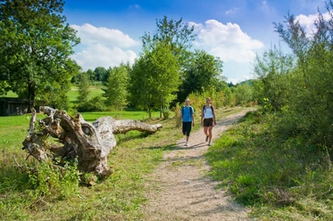
The varied route convinces with pleasant ascents and descents, beautiful distant views, and culinary delights.
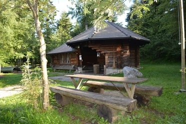
The circular hike starts at the market square opposite the church in the village center. Here you will find various shops with fine regional products, for example, the bakery Kreisel-Beck or the self-service shop of the Biosphere Mountain Cheese Dairy, where you can also stock up on provisions for the hiking tour. After the shopping tour, the path leads through the school grounds to Wilgutstrasse. At the upper end, you climb steps to a small path and reach a meadow path to Schlüeli. At Luegisland there are two nice benches for a short drink break. The meadow path above Luegisland is partly not easy to see.
Outstanding is the view from the hill Luegisland into the village, to the wind turbines, and across the entire valley. At Lustenberg, you walk past a pretty wayside chapel, and below Schluecht on the left, you can see an ancient hollow way - a deeply incised path. Shortly before you return to the village, you pass the farm and the organic cheese dairy Emscha. A family business producing 100% pure sheep milk specialties in an environmentally friendly way. Take a short detour to the Schafbuur farm shop before returning to the market square.
- 1:15 h
- 3.86 km
- 176 m
- 176 m
- 727 m
- 903 m
- 176 m
- Start: Entlebuch Market Square
- Destination: Entlebuch Market Square
Good to know
Pavements
- Street (6%)Asphalt (46%)Gravel (2%)Trail (37%)Path (9%)
Best to visit
- suitableDepends on weather
Directions
Marktplatz – Wilgutquartier – Schlüeli – Luegisland – Lustenberg – Schluecht – Veebode - Marktplatz
The route is only marked as a hiking trail from the Schluecht property onwards.
Tour information
Circular trail
Refreshment stop
Equipment
Good footwear, rain jacket & sufficient drinking water for the journey are essential for every hike.
Further tips for safe hiking, information on cow-calf herds and guardian dogs, and much more can be found on the website of Swiss Hiking Trails.
Directions & Parking facilities
- Getting there
The UNESCO Biosphere Entlebuch lies in the heart of Switzerland, centrally between Bern and Lucerne. You can reach Entlebuch via the main road 10. From Sarnen, you drive over the Glaubenberg Pass to Entlebuch.
Plan your route with the help of the Google route planner.
ParkingA paid parking lot is available at the Entlebuch market square.
Public transportationYou can reach Entlebuch by public transport via the Bern-Lucerne train line.
Plan your trip with the SBB online timetable.
Additional information
Literature
- The brochure "Discover and admire Entlebuch" is available online at www.tourismus-entlebuch.ch.
Author
UNESCO Biosphäre Entlebuch
Organization
UNESCO Biosphäre Entlebuch
Author´s Tip / Recommendation of the author
At the start of the hike, you will find a regional bakery, cheese dairy, and butcher - ideal also for a picnic on the go.
Safety guidelines
The meadow path above Luegisland is partly not easy to see.
Nearby


Download GPX file