Circular hike in the Ebnet area


The hike starts at Lindenhof Ebnet with an ascent, first through open terrain and later through the Bramegg forest. In the upper part, the hiking trail follows the former pack animal trail Entlebuch–Lucerne – a deeply incised sunken path. Until the end of the 18th century, the difficult traffic conditions between Entlebuch and the city of Lucerne were no problem for the people of Entlebuch. On the contrary: they could pursue their trade with the people from Emmental and Alsace wine merchants undisturbed. The route across the Bramegg with its distinctive sunken paths served as the main connection until a new road over the Rengg in 1825 and the cantonal road over Wolhusen in the 1840s replaced the pack animal trail.
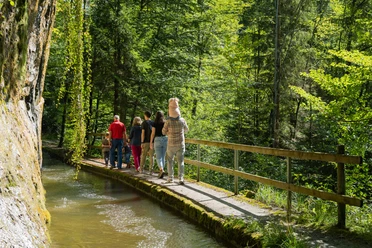
The view into the Napf area, the Central Plateau and the Pre-Alps is impressive. Shortly before the picnic area in Staldigwald, the trail leads into a forest reserve with ponds (Attention: at the trail junction after the pond keep slightly right). After the break, the route continues downhill. Between Sagili and Stalde, you walk on the old Schwanderholz road, visible due to the preserved paving.
The hike ends again at Lindenhof Ebnet. Lindenhof relies on regionality in its restaurant - under the motto sustainably enjoyable, the small fine producers from the surrounding area are considered. Of course, the Entlebuch beer or the Edelwhite Gin may not be missing, which also have their production sites at Lindenhof. Inform yourself in advance about the opening hours.
- 3:10 h
- 11.19 km
- 306 m
- 306 m
- 680 m
- 985 m
- 305 m
- Start: Restaurant Lindenhof, Ebnet
- Destination: Restaurant Lindenhof, Ebnet
Good to know
Pavements
Best to visit
Directions
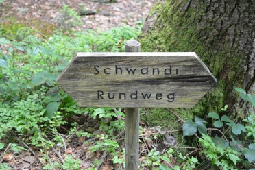
Restaurant Lindenhof Ebnet - Ober Zeugweid – Alp – Herbrächt – Oberstaldig – Chlosterwald – Häntschen – Schwanderholz – Maischwand – Restaurant Lindenhof
The following routes are marked as hiking trails: Ebnet to Staldigwald, P. 888 to P. 778, P. 714 to Stalde. The unmarked routes in Staldigwald, in Holzwald and near Burgsite consist of well-visible small roads and forest paths. Attention: Follow the signpost at Underwald towards Dünnhirs/Werthenstein.
Tour information
Loop Road
Equipment
Good footwear, a rain jacket & sufficient drinking water for the way belong to every hike.
Further tips for safe hiking, information on cow-calf herds and livestock guardian dogs and much more are available on the website of Swiss Hiking.
Directions & Parking facilities
The UNESCO Biosphere Entlebuch is located in the heart of Switzerland, centrally between Bern and Lucerne. You can reach Ebnet/Entlebuch via main road 10. From Sarnen, drive over the Glaubenberg Pass to Entlebuch and then continue towards the district of Ebnet.
Plan your route with the help of the Google route planner.
A free parking lot is available at Restaurant Lindenhof Ebnet.
You can reach Entlebuch by public transport via the Bern-Lucerne railway line. From Monday to Friday during the school term, you can reach Ebnet with individual post bus services. On weekends and during school holidays, there are no public transport connections.
Plan your trip with the SBB online timetable.
Additional information
Literature
Author
UNESCO Biosphäre Entlebuch
Organization
UNESCO Biosphäre Entlebuch
Author´s Tip / Recommendation of the author
Plan a break at the picnic area in Staldigwald - it is equipped with water and toilets.
Nearby


Download GPX file