Circular route Wiggerenhütte - Napf


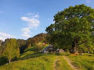
This route to the Napf is probably one of the shortest. Although the path leads exclusively through the forest, there are always beautiful views into the Napfberg region and over to the Trachselegg. There are plenty of benches and simple grill areas along the way.
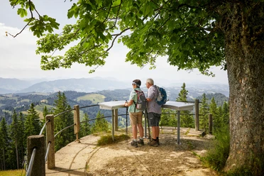
It is always a wonderful moment when, after about an hour, the Bernese Alps appear behind the last hairpin bend and the triangulation point of the Napf comes into view.
- 2:06 h
- 5.22 km
- 429 m
- 429 m
- 975 m
- 1,404 m
- 429 m
- Start: Wiggerenhütten parking lot
- Destination: Wiggerenhütten parking lot
Good to know
Pavements
Best to visit
Directions
At the parking lot, the path leads right in a southern direction steadily uphill.
Wiggernhütte-Napf-Wiggernhütte
Tour information
Loop Road
Stop at an Inn
Summit
Equipment
- Clothing suitable for the weather
- Good footwear
- Trekking poles are recommended
- Camera
- Daypack
Directions & Parking facilities
Additional information
Arrival by PostBus to Hübeli, Sagenmatt (final stop). The hike is thereby extended by about 1 hour per route. A description of this route can be found under the description of the hike Menzberg - Hübeli (Hergiswil).
Author
Willisau Tourismus
Organization
Willisau Tourismus
Author´s Tip / Recommendation of the author
As an alternative return route, take the path via Stächelegg, this route also leads back to the Wiggernhütte parking lot.
How is the weather? Here you can access the webcams.
Map
Nearby

Download GPX file