Emmenuferweg stage 4: Wolhusen-Emmenbrücke


The fourth and final stage of the Emmenuferweg is perfect for hot days: From Wolhusen, it goes along the shady banks of the Kleine Emme via Schachen, Malters and Littau to Emmenbrücke. Numerous bathing spots invite you to cool off along the way.
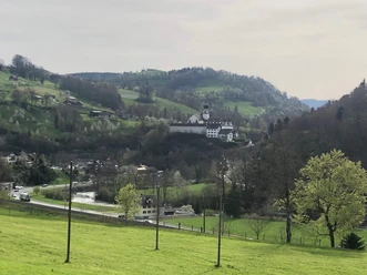
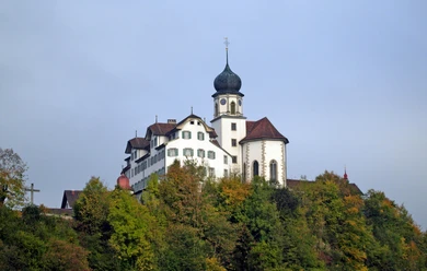
Shortly after starting the hike in Wolhusen, you can already see the monastery towering over Werthenstein. The historically significant place is a magnet for pilgrims. The path up to the monastery leads over an old wooden bridge, past the Gnadenbrünneli. The Franciscans already interpreted the spring as a mystical source of grace in 1649. The spring water is said to have special healing powers and can be filled into a water bottle.
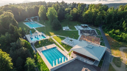
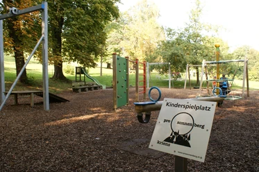
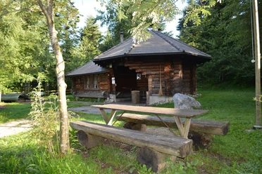
Back on the Emme bank, you repeatedly come across nicely situated benches inviting you to pause for a moment. You enjoy the view of the mosaic-like landscape with green meadows, deciduous forests, hedges and scattered farms. Shortly afterwards, you reach the Schwellisee, an extensive sedimentation plain with gravel banks and a shallow riverbed. Here, you can wonderfully cool your feet and enjoy the sun. The playground with beautiful wooden elements and a barbecue area invites you to take a break before the next section to Emmenbrücke is tackled on foot. Sunny stretches over fields and meadows alternate with shady floodplain forests until you increasingly approach the pulsating agglomeration of the city of Lucerne in Littau.
On the last section, industrial buildings contrast with the tree- and shrub-lined Emme bank trail, which continues to follow the course of the water. Shortly before Emmenbrücke, you pass through part of the former viscose area, today called Viscosistadt. Viscosuisse was one of the largest textile companies in Switzerland and was among the pioneers of the European chemical fiber industry. The industrial buildings from the company's heyday are still well preserved today and complete the industrial charm of the city district at the gates of Lucerne. The route ends in Emmenbrücke through one of the most charming river landscapes with the confluence of the Emme into the Reuss.
- 5:00 h
- 19.49 km
- 73 m
- 211 m
- 434 m
- 600 m
- 166 m
- Start: Wolhusen train station
- Destination: Lucerne train station
Good to know
Pavements
Best to visit
Directions
Wolhusen train station - Werthenstein - Malters - Littau - Lucerne train station
The route is marked with signposts «83 Emmenuferweg» up to Emmenbrücke.
The path lies directly at all BLS stations on the Lucerne-Schüpfheim route. It thus offers convenient opportunities to hike any desired sections individually.
Equipment
Good footwear, a rain jacket & sufficient drinking water for the way are part of every hike.
More tips for safe hiking, information about suckler cow herds and guardian dogs and much more can be found on the website of the Swiss Hiking Routes.
Directions & Parking facilities
You can reach Wolhusen or Emmenbrücke via main road 10.
Various paid parking spaces are available at the train stations.
You can reach Wolhusen by public transport via the Bern-Lucerne train line.
Plan your trip with the SBB Online Timetable.
Additional information
UNESCO Entlebuch Biosphere
Biosphere Centre
Chlosterbüel 28
CH-6170 Schüpfheim
Phone +41 (0)41 485 42 50
www.biosphaere.ch
Author
UNESCO Biosphäre Entlebuch
Organization
UNESCO Biosphäre Entlebuch
Author´s Tip / Recommendation of the author
The Schwellisee Malters invites you to relax and cool off on hot summer days.

Nearby
