Engelstock LOOP trail

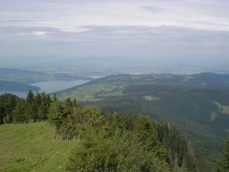
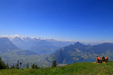
You can almost touch the Schwyz Basin with the lakes of Lauerz and Lucerne as well as the Mythen twin peaks, the Fronalpstock and the Rigi.
The trail leads across easy terrain from the Mostelberg mountain station all around the Engelstock. The well-kept path is also suitable for less experienced hikers and for children.
- 1:35 h
- 5.49 km
- 158 m
- 158 m
- 1,147 m
- 1,266 m
- 119 m
- Start: Mostelberg Mountain Station
- Destination: Mostelberg Mountain Station
Waypoints

Good to know
Pavements
- Asphalt (57%)Trail (43%)
Best to visit
- suitableDepends on weather
Directions
- The Engelstock Circular Trail starts at the Mostelberg mountain station. From there, the trail leads past the “Skywalk” pedestrian suspension bridge and the toboggan run toward Herrenboden.After passing the Herrenboden restaurant and the Hochstuckli ski lift, the trail climbs up to Mostelegg. Enjoying breathtaking views, follow the trail to the Blüemlisberg goat farm and on to the Engelstockweid.
After about 1.5 hours, you’ll return to the starting point.
Tour information
Circular trail
Refreshment stop
Equipment
- For theEngelstock LOOP trail, we recommend wearing weather-appropriate clothing and sturdy footwear, such as trekking shoes or hiking boots. This will allow you to enjoy the hike comfortably and safely—whether it’s sunny, windy, or rainy.
Directions & Parking facilities
- Getting thereDirections from Zug:
From Zug via Aegerital. Then follow the signs to Sattel.Coming from Lucerne:
Take the A4/E41 highway to exit 39, leave the highway in the direction of Schwyz, Sattel, Einsiedeln and then follow the signs to Sattel. In the village of Sattel, turn right into Steinerbergstrasse and then left to the Sattel-Hochstuckli revolving gondola parking lot.Coming from Ticino:
Follow Axenstrasse on the A4/E41 highway until exit 39. Leave the highway in the direction of Schwyz, Sattel, Einsiedeln and then follow the signs to Sattel. In the village of Sattel, turn right into Steinerbergstrasse and then left to the Sattel-Hochstuckli revolving gondola parking lot.Coming from Zurich:
Take the A3 highway to exit 37. Leave the highway in the direction of Richterswil, Einsiedeln, Samstagern and follow the road in the direction of Sattel and Schwyz. In Sattel, turn right and then left into Steinerbergstrasse before arriving at the Sattel-Hochstuckli revolving gondola parking lot on the left.ParkingPaid parking spaces are available at the valley station of the "Stuckli Rondo" revolving gondola lift.Public transportationSüdostbahn (SOB) S31 from Rapperswil, Pfäffikon, Wädenswil, Einsiedeln, Lucerne, Arth-Goldau. Sattel-Aegeri" station (6 minutes on foot to the valley station of the gondola lift).Voralpen-Express: fast train connection Romanshorn-St.Gallen-Lucerne (stops in Biberbrugg and Arth-Goldau). Connecting buses from Biberbrugg (direction Rothenthurm-Sattel-Schwyz). Auto AG Schwyz (AAGS) from Schwyz (Sattel stop, gondola lift).Zugerland Verkehrsbetriebe (ZVB) from Zug (bus route 601) to Oberägeri, change to bus route 609 to the Sattel stop, take the gondola lift. Author
Madeleine Keller
Organization
Sattel-Hochstuckli

Nearby



Download GPX file