Flower Walk


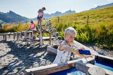
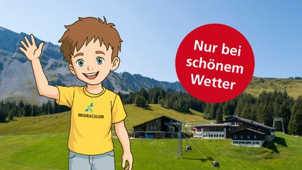
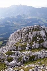
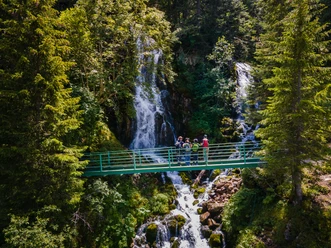
Immediately behind the Rossweid, the path enters a fern-rich blueberry-spruce forest and you feel like you're in another world: bark beetles and storms have left gaps in the forest where, besides spruces, deciduous trees like rowan and willow as well as numerous herbaceous plants grow. Embedded in the forest lies calcareous small sedge meadows covered with pink glowing orchids and white tufts of cotton grass. After Salwide, the path leads through raised bog mountain pine forests and mountain fat meadows up to Blattenegg, with repeated views opening to the impressive Schratenflue. On the way back to Rossweid lies the moor educational trail "Mooraculum," which is also offered as a separate short route from Rossweid, especially suitable for families with children.
- 2:00 h
- 6.74 km
- 213 m
- 213 m
- 1,423 m
- 1,636 m
- 213 m
- Start: Rossweid
- Destination: Rossweid
Waypoints
Good to know
Pavements
Best to visit
Tour information
Loop Road
Nature Highlight
Tour with Dog
Equipment
Good footwear, rain jacket & enough drinking water for the way belong to every hike.
Further tips for safe hiking, information about suckler cow herds and livestock guardian dogs and much more can be found on the website of Swiss Hiking Trails.
Directions & Parking facilities
You can reach Sörenberg via main road 10 towards Schüpfheim and from there to Flühli Sörenberg to the village center of Sörenberg.
In summer you can reach Sörenberg via Sarnen - Giswil over the Glaubenbielen Pass.
A paid parking lot is available at the valley station of the Rossweid gondola lift.
You can reach Sörenberg by public transport via Schüpfheim (Bern-Lucerne railway line). From Schüpfheim, take the PostBus to Sörenberg, Post. Plan your trip with the SBB Online Timetable.
Author
Sörenberg Flühli Tourismus
Organization
UNESCO Biosphäre Entlebuch

Nearby


Download GPX file