Flüeli - Sachseln

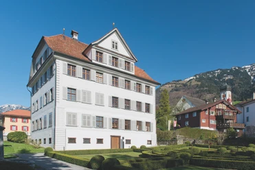
Directly at the Flüeliplatz stands the house built by Niklaus von Flüe (1417-1487), where he lived as a farmer and councilman with his family before retreating in 1467 as Brother Klaus to the hermit life in the Ranft. A direct hiking trail gently climbs over Bitzi – Hostettli – Balmetschwand to Schluecht - Oberriedmattli, from where a forest path is reached cross-country. This leads southwest along the edge of the forest to point 842 and then through the gorge of the Sachsler Dorf creek and the Schwanden forest to the geographical center (point 857) of the canton of Obwalden. It was marked in 2009 at the conclusion of the official survey (AV93) with a stele, and next to it a shelter with a grill was built. Only from a few places can one enjoy such a comprehensive view over the entire Sarneraatal.
Sufficient snow allows you to stroll directly down the wide slopes from Gloters to Spilmoos, parallel to the hiking trail that leads down to the village creek at point 686 and follows it to the shooting range and through Steinen to the pilgrim village. A visit to the parish church, which has housed the grave of Brother Klaus since 1679 and whose effectiveness as mystic, mediator, and man was commemorated in a memorial year in 2017, is worthwhile here. Various inns invite you to a well-deserved refreshment from the exertions.
- 2:44 h
- 6.65 km
- 259 m
- 516 m
- 471 m
- 982 m
- 511 m
- Start: Flüeli-Ranft
- Destination: Sachseln station
Good to know
Best to visit
Tour information
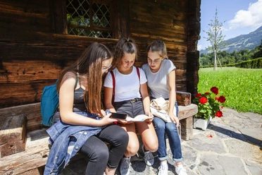
Familiy-Friendly
Stop at an Inn
Directions & Parking facilities
On the A2 from Lucerne, change in the tunnel to the A8 towards Interlaken, Sarnen, and then follow the road to the Sarnen Süd exit. At the roundabout, take the third exit towards Sachseln.
From Interlaken via Brünig on the A8 to the Giswil Nord exit. Continue on the main road to Sachseln.
Author
Obwalden Tourismus
Organization
Obwalden Tourismus
Author´s Tip / Recommendation of the author
Geographical center of the canton of Obwalden at coordinates 661'442/189'581
This hike is at a maximum altitude of 981 m above sea level and is only accessible with snowshoes if there has been snowfall down into the valley. Check the snow conditions in advance.
Safety guidelines
Nearby