Geissä Wäg Theme and Adventure Trail


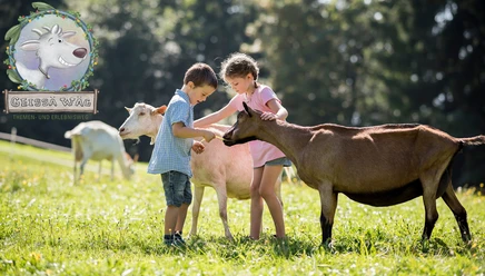
The themed nature trail features seven interactive stations that explain the world of goats in a playful way. Fun, games, and plenty of educational activities for the whole family.
The walking time for the trail is about 45 minutes with children, not including the interactive stations or any stops at fire pits or lookout points.
At the valley or mountain station—or at the Blüemlisberg Goat Farm—each child receives a “Goat Booklet” containing a picture to color, a coupon for the solution word, and an explanation of the entire “Goat Trail.” That’s because there’s a puzzle to solve at every station.
Anyone who figures out the solution word can enter a contest.
- 0:40 h
- 2.50 km
- 40 m
- 48 m
- 1,147 m
- 1,191 m
- 44 m
Waypoints
Good to know
Pavements
- Asphalt (6%)Trail (94%)
Best to visit
- suitableDepends on weather
Directions
- The Geissä Wäg trail starts at the Mostelberg mountain station and follows a well-maintained hiking trail around the Engelstock to the Blüemlisberg goat farm. This family-friendly themed adventure trail is suitable for all ages and can even be navigated with all-terrain strollers. The walking time alone is about 45 minutes, but you should plan on 1.5 to 2 hours for the full experience, including the play stations and rest areas.
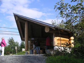
The trail winds through varied mountain landscapes featuring lush alpine meadows, shady forest sections, and magnificent viewpoints. Impressive views of the Mythen and the surrounding Central Swiss mountains open up time and again. Fire pits along the route invite you to take a leisurely break.
From the Blüemlisberg goat farm, you can either take the same trail back to Mostelberg or continue the hike along the loop trail around the Engelstock.
Directions & Parking facilities
- Getting thereDirections from Zug:
From Zug via the Aegerital. Then follow the signs toward Sattel.Directions from Lucerne:
Take the A4/E41 highway to Exit 39. Exit the highway toward Schwyz, Sattel, and Einsiedeln, then follow the signs toward Sattel. In the village of Sattel, turn right onto Steinerbergstrasse and then left toward the parking lot for the Sattel-Hochstuckli revolving gondola.Directions from Ticino:
After Axenstrasse, take the A4/E41 highway to Exit 39. Exit the highway toward Schwyz, Sattel, and Einsiedeln, then follow the signs toward Sattel. In the village of Sattel, turn right onto Steinerbergstrasse and then left toward the parking lot for the Sattel-Hochstuckli rotating gondola.Directions from Zurich:
Take the A3 highway to Exit 37. Exit the highway toward Richterswil, Einsiedeln, and Samstagern, and follow the road toward Sattel and Schwyz. In Sattel, turn right and then left onto Steinerbergstrasse before turning left to the parking lot for the Sattel-Hochstuckli rotating gondola.ParkingPaid parking is available at the lower station of the "Stuckli Rondo" rotating gondola.Public transportationSüdostbahn (SOB) S31 from Rapperswil, Pfäffikon, Wädenswil, Einsiedeln, Lucerne, Arth-Goldau. "Sattel-Aegeri" train station (6-minute walk to the gondola’s valley station). Voralpen-Express: Express train service between Romanshorn, St. Gallen, and Lucerne (stops in Biberbrugg and Arth-Goldau). Connecting buses from Biberbrugg (toward Rothenthurm-Sattel-Schwyz). Auto AG Schwyz (AAGS) from Schwyz (Sattel stop, gondola).Zugerland Public Transportation (ZVB) from Zug (Bus Line 601) to Oberägeri; transfer to Bus Line 609 to the Sattel stop, then take the gondola. Author
Madeleine Keller
Organization
Sattel-Hochstuckli