Herrenrüti


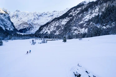
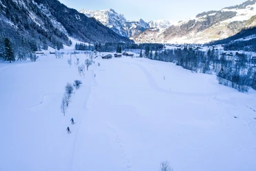
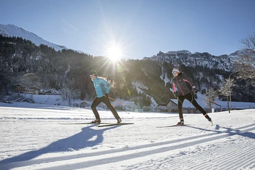
The starting point of this cross-country route is the Fürenalp cable car valley station. The physically and technically demanding route is just over 4 kilometers long and includes a steep climb up to Herrenrüti. The route starts off gently with only a slight ascent over the Herrenrütiboden. From there it goes steeply uphill always heading towards the Spannörtern. Once reached on the Herrenrüti, the route leads after a short loop back down to the starting point. Located at the very end of the valley, the route is uniquely scenic. One almost feels transported back in time and apart from one's own breath and the crunching of the snow, nothing can be heard.
- 0:45 h
- 4.34 km
- 100 m
- 101 m
- 1,074 m
- 1,175 m
- 101 m
- Start: Fürenalp valley station
- Destination: Fürenalp valley station
Good to know
Best to visit
- suitableDepends on weather
Tour information
Circular trail
Equipment
Cross-country ski equipment can be rented at the sports shops in Engelberg.
Directions & Parking facilities
- Getting thereBy car, drive on the A2 (Basel-Gotthard) to Stans South, then 20 km on the main road to Engelberg. Engelberg is 30 minutes from Lucerne, 1 hour and 15 minutes from Basel, Zurich, or Bern.ParkingParking is available in Engelberg for a fee.Public transportationNational and international connections (from Zurich Airport, connections every half hour with about 1 hour travel time) to Lucerne. Then with the Zentralbahn in 43 minutes through varied landscapes and gorges up to Engelberg.
Additional information
Author
Engelberg - Titlis Tourismus
Organization
Engelberg-Titlis Tourismus
Author´s Tip / Recommendation of the author
- The route can be extended as desired and combined with the valley trail. Via the valley trail you reach the Nordic Center in the village, or use the free sports bus to get to the starting point of the route.
Nearby




Download GPX file