Hike above the fog (Hämikon Berg - Horben - Hämikon Berg)


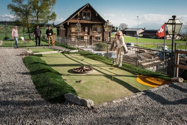
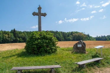
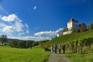
The circular hike starts at Gasthaus Hämikerberg. Right at the beginning of the route, on the high plateau of the Lindenberg, you will find yourself in “Klein-Ballenberg.” This is the name given to the collection of old farmhouses from Central Switzerland located on the Hämikerberg. Here you can try Spiel-Golf – a mix of golf and mini golf. After the game, you set off along field paths to reach Sulzerkreuz. From here, you can enjoy the view of Lake Baldegg, Pilatus, and the surrounding peaks. Along the edge of the forest, the hiking trail takes you via Oberillau to the castle and the alpine inn Horben. The 18th-century castle was the summer residence of the monks of Muri Abbey and is a cultural heritage site of national significance. It is now privately owned and can only be admired from outside. A stop at the alpine inn Horben is worthwhile throughout the year. Especially in autumn and winter, Horben often rises above the fog, allowing a cozy lunch enjoyed in the sun. Before your excursion, consult the webcam of the alpine inn Horben www.horben.ch.
Order now the free hiking guide from the Seetal region.
- 2:50 h
- 11.24 km
- 115 m
- 115 m
- 782 m
- 858 m
- 76 m
- Start: Hämikon, Berg
- Destination: Hämikon, Berg
Waypoints
Good to know
Pavements
Best to visit
Directions
Tour information
Loop Road
Directions & Parking facilities
Additional information
Seetal Tourism
Niederlenzerstrasse 25
5600 Lenzburg
+41 (0)41 920 45 29
[email protected]
www.seetaltourismus.ch
Author
Seetal Tourismus
Organization
Seetal Tourismus
Author´s Tip / Recommendation of the author
- Gasthaus Hämikerberg: www.gasthaus-haemikerberg.ch (closed on Mondays)
- Spiel!Golf Hämikerberg: www.spielgolf-schweiz.ch
- Alpwirtschaft Horben: www.horben.ch (closed on Tuesdays)
- Sulzer Kreuz
Map
Topographic map 1:25,000 (Federal Office for Topography swisstopo) Hochdorf sheet
Hiking map 1:50,000 (Federal Office for Topography swisstopo) Rotkreuz sheet
Nearby
Download GPX file